Les Souhesmes-Rampont
Les Souhesmes-Rampont | |
|---|---|
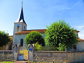 The church of Saint-Airy in Les Souhesmes-Rampont | |
 Coat of arms | |
show Location of Les Souhesmes-Rampont | |
 Les Souhesmes-Rampont | |
| Coordinates: 49°05′04″N 5°15′10″E / 49.0844°N 5.2528°ECoordinates: 49°05′04″N 5°15′10″E / 49.0844°N 5.2528°E | |
| Country | France |
| Region | Grand Est |
| Department | Meuse |
| Arrondissement | Verdun |
| Canton | Dieue-sur-Meuse |
| Intercommunality | Val de Meuse - Voie Sacrée |
| Government | |
| • Mayor (2020–2026) | Gérard Buys |
| Area 1 | 21.8 km2 (8.4 sq mi) |
| Population (Jan. 2018)[1] | 335 |
| • Density | 15/km2 (40/sq mi) |
| Time zone | UTC+01:00 (CET) |
| • Summer (DST) | UTC+02:00 (CEST) |
| INSEE/Postal code | 55497 /55220 |
| Elevation | 225–327 m (738–1,073 ft) (avg. 250 m or 820 ft) |
| 1 French Land Register data, which excludes lakes, ponds, glaciers > 1 km2 (0.386 sq mi or 247 acres) and river estuaries. | |


Les Souhesmes-Rampont (French pronunciation: [le su.ɛm ʁɑ̃pɔ̃]) is a commune in the Meuse department in Grand Est in north-eastern France.
See also[]
References[]
- ^ "Populations légales 2018". INSEE. 28 December 2020.
| Wikimedia Commons has media related to Les Souhesmes-Rampont. |
| show Authority control |
|---|
This Meuse geographical article is a stub. You can help Wikipedia by . |
Categories:
- Communes of Meuse (department)
- Meuse (department) geography stubs