Lherm, Haute-Garonne
Lherm | |
|---|---|
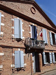 Town hall | |
 Coat of arms | |
show Location of Lherm | |
 Lherm | |
| Coordinates: 43°25′52″N 1°13′22″E / 43.4311°N 1.2228°ECoordinates: 43°25′52″N 1°13′22″E / 43.4311°N 1.2228°E | |
| Country | France |
| Region | Occitanie |
| Department | Haute-Garonne |
| Arrondissement | Muret |
| Canton | Cazères |
| Government | |
| • Mayor (2020–2026) | Frédéric Pasian |
| Area 1 | 27.26 km2 (10.53 sq mi) |
| Population (Jan. 2018)[1] | 3,726 |
| • Density | 140/km2 (350/sq mi) |
| Time zone | UTC+01:00 (CET) |
| • Summer (DST) | UTC+02:00 (CEST) |
| INSEE/Postal code | 31299 /31600 |
| Elevation | 187–240 m (614–787 ft) (avg. 225 m or 738 ft) |
| 1 French Land Register data, which excludes lakes, ponds, glaciers > 1 km2 (0.386 sq mi or 247 acres) and river estuaries. | |


Lherm (French pronunciation: [lɛʁm]; Occitan: L'Èrm) is a commune in the Haute-Garonne department in southwestern France.
Geography[]
The commune is traversed by the river Touch.
Population[]
| Year | Pop. | ±% |
|---|---|---|
| 1962 | 755 | — |
| 1968 | 834 | +10.5% |
| 1975 | 1,092 | +30.9% |
| 1982 | 1,858 | +70.1% |
| 1990 | 2,266 | +22.0% |
| 1999 | 2,558 | +12.9% |
| 2008 | 3,277 | +28.1% |
See also[]
References[]
- ^ "Populations légales 2018". INSEE. 28 December 2020.
| Wikimedia Commons has media related to Lherm (Haute-Garonne). |
| show Authority control |
|---|
This Haute-Garonne geographical article is a stub. You can help Wikipedia by . |
Categories:
- Communes of Haute-Garonne
- Haute-Garonne geography stubs