Longages
Longages | |
|---|---|
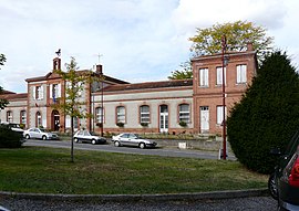 Town hall | |
show Location of Longages | |
 Longages | |
| Coordinates: 43°21′21″N 1°14′27″E / 43.3558°N 1.2408°ECoordinates: 43°21′21″N 1°14′27″E / 43.3558°N 1.2408°E | |
| Country | France |
| Region | Occitanie |
| Department | Haute-Garonne |
| Arrondissement | Muret |
| Canton | Auterive |
| Government | |
| • Mayor (2020–2026) | Jean-Michel Dallard |
| Area 1 | 21.42 km2 (8.27 sq mi) |
| Population (Jan. 2018)[1] | 3,104 |
| • Density | 140/km2 (380/sq mi) |
| Time zone | UTC+01:00 (CET) |
| • Summer (DST) | UTC+02:00 (CEST) |
| INSEE/Postal code | 31303 /31410 |
| Elevation | 190–220 m (620–720 ft) (avg. 194 m or 636 ft) |
| 1 French Land Register data, which excludes lakes, ponds, glaciers > 1 km2 (0.386 sq mi or 247 acres) and river estuaries. | |


Longages (French pronunciation: [lɔ̃ɡaʒ]; Occitan: Longatges) is a commune in the Haute-Garonne department in southwestern France.
Population[]
| Year | Pop. | ±% |
|---|---|---|
| 1962 | 908 | — |
| 1968 | 921 | +1.4% |
| 1975 | 1,101 | +19.5% |
| 1982 | 1,332 | +21.0% |
| 1990 | 1,691 | +27.0% |
| 1999 | 1,899 | +12.3% |
| 2008 | 2,552 | +34.4% |
Sights[]
The Château Sainte-Marie is a castle dating from the second half of the 16th century, modified and altered during the 19th century. It is listed as a historic site by the French Ministry of Culture.[2]
Transport[]
See also[]
References[]
- ^ "Populations légales 2018". INSEE. 28 December 2020.
- ^ Base Mérimée: Château Sainte-Marie, Ministère français de la Culture. (in French)
| Wikimedia Commons has media related to Longages. |
This Haute-Garonne geographical article is a stub. You can help Wikipedia by . |
Categories:
- Communes of Haute-Garonne
- Haute-Garonne geography stubs