Morbier
Morbier | |
|---|---|
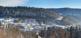 A view of Morbier | |
 Coat of arms | |
show Location of Morbier | |
 Morbier | |
| Coordinates: 46°32′15″N 6°01′03″E / 46.5375°N 6.0175°ECoordinates: 46°32′15″N 6°01′03″E / 46.5375°N 6.0175°E | |
| Country | France |
| Region | Bourgogne-Franche-Comté |
| Department | Jura |
| Arrondissement | Saint-Claude |
| Canton | Morez |
| Government | |
| • Mayor (2020–2026) | Daniel Flament |
| Area 1 | 34.84 km2 (13.45 sq mi) |
| Population (Jan. 2018)[1] | 2,278 |
| • Density | 65/km2 (170/sq mi) |
| Time zone | UTC+01:00 (CET) |
| • Summer (DST) | UTC+02:00 (CEST) |
| INSEE/Postal code | 39367 /39400 |
| Elevation | 650–1,180 m (2,130–3,870 ft) |
| 1 French Land Register data, which excludes lakes, ponds, glaciers > 1 km2 (0.386 sq mi or 247 acres) and river estuaries. | |


Morbier is a commune in the Jura department in the Bourgogne-Franche-Comté region in Eastern France. In 2018, it had a population of 2,278.[2] From 1680 to 1920, Morbier was, with Morez, the centre of Comtoise clock production. It is part of part of Haut-Jura Regional Natural Park.
Population[]
|
|
See also[]
References[]
- ^ "Populations légales 2018". INSEE. 28 December 2020.
- ^ INSEE statistics
| Wikimedia Commons has media related to Morbier (Jura). |
| show Authority control |
|---|
Categories:
- Communes of Jura (department)