Rezé
Rezé | |
|---|---|
Commune | |
 City center | |
 Coat of arms | |
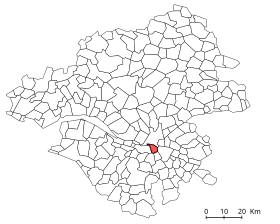
show Location of Rezé | |
 Rezé | |
| Coordinates: 47°11′00″N 1°33′00″W / 47.1833°N 1.55°WCoordinates: 47°11′00″N 1°33′00″W / 47.1833°N 1.55°W | |
| Country | France |
| Region | Pays de la Loire |
| Department | Loire-Atlantique |
| Arrondissement | Nantes |
| Canton | Rezé-1 and 2 |
| Intercommunality | Nantes Métropole |
| Government | |
| • Mayor (2020–2026) | Hervé Neau |
| Area 1 | 13.78 km2 (5.32 sq mi) |
| Population (Jan. 2018)[1] | 42,368 |
| • Density | 3,100/km2 (8,000/sq mi) |
| Time zone | UTC+01:00 (CET) |
| • Summer (DST) | UTC+02:00 (CEST) |
| INSEE/Postal code | 44143 /44400 |
| Elevation | 1–42 m (3.3–137.8 ft) (avg. 8 m or 26 ft) |
| 1 French Land Register data, which excludes lakes, ponds, glaciers > 1 km2 (0.386 sq mi or 247 acres) and river estuaries. | |


Rezé (French: [ʁəze] (![]() listen); Breton: Reudied, Gallo: Rezae) is a commune (municipality) and former bishopric in the Loire-Atlantique department in the Pays de la Loire region of western France.
listen); Breton: Reudied, Gallo: Rezae) is a commune (municipality) and former bishopric in the Loire-Atlantique department in the Pays de la Loire region of western France.
It was also called Ratiate in the Middle Ages and Rezay in the High Middle Ages.

History[]
Rezé dates back to the Roman era, when it was known as Portus Ratiatus (port of Rezé) and Ratiatum Pictonum Portus (picton port of Rezé). Being populated by the tribe - Armorican Gauls - Rezé was an important port on the south shore of the Loire and a place for meetings and trade between the various Celtic tribes of the region (Veneti, Namnetes, , and Pictones).
In 510 a Latin Catholic Diocese of Rezé was established on territory split off from the Diocese of Poitiers. It was suppressed 851, its territory being reassigned to the nearby then Diocese of Nantes. No incumbents or other details available.
It has ruins of Gallo-Roman settlement and a priory of Saint Lucien.
In the feudal age, it was the capital of the Pays de Retz within the Duchy of Brittany.
Geography[]
The commune is surrounded by the communes of Nantes, Vertou, Les Sorinières, Pont-Saint-Martin and Bouguenais. It is limited north by the Loire, east by the Sèvre Nantaise and the Ilette, west by the Jaguère and south by the boulevard périphérique of Nantes.
Municipal administration[]
Since the municipal elections of 1977, the communal council has always been filled in the first round of voting.
| Term | Name | Political Party | Position |
|---|---|---|---|
| September 1944-May 1945 | Jean Vignais (1878–1954) | Radical Socialist | |
| May 1945-March 1949 | Arthur Boutin (1903–1980) | SFIO | General Council |
| March 1949-March 1959 | Georges Albert Bénezet (1892–1970) | RPF | |
| March 1959-February 1978 | Alexandre Plancher (1909–1978) | SFIO | General Council |
| April 1978-February 1999 | (1938- ) | PS | Deputy |
| 1999–2014 | Gilles Retière | PS | |
| 2014–2020 | Gérard Allard | PS | |
| 2020–incumbent | Hervé Neau | DVG | |
|
Sources: Yann Vince, "Rezé, histoire municipale" éditions Hérault, 1997 and Annuaire-Mairie[2] | |||
Population[]
|
| |||||||||||||||||||||||||||||||||||||||||||||||||||||||||||||||||||||||||||||||||||||||||||||||||||||||||||||||
| Source: EHESS[3] and INSEE[4] | ||||||||||||||||||||||||||||||||||||||||||||||||||||||||||||||||||||||||||||||||||||||||||||||||||||||||||||||||
International relations[]
Rezé is twinned with:
 Saint-Wendel (Germany) since 1973
 Aïn Defla (Algeria) since 1985
 Dundalk (Ireland) since 1990
 Villa El Salvador (Peru) since 1991
 Ineu (Romania) since 2003
 Rural Community of Ronkh, Diawar (Senegal) since 2003
 Abu Dis (Palestine) since 2007[5]
See also[]
- Communes of the Loire-Atlantique department
- List of Catholic dioceses in France
References[]
- ^ "Populations légales 2018". INSEE. 28 December 2020.
- ^ Ville de Rezé, annuaire-mairie.fr, accessed 17 May 2021
- ^ Des villages de Cassini aux communes d'aujourd'hui: Commune data sheet Rezé, EHESS. (in French)
- ^ INSEE: Population en historique depuis 1968
- ^ Reze Website [1].
External links[]
| Wikimedia Commons has media related to Rezé. |
- Official website (in French)
- GCatholic - former bishopric
- Nouveau Larousse Illustré
| show Authority control |
|---|
- Communes of Loire-Atlantique