Saint-Cyr-Montmalin
Saint-Cyr-Montmalin | |
|---|---|
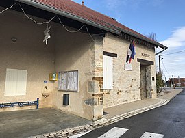 The town hall in Saint-Cyr-Montmalin | |
show Location of Saint-Cyr-Montmalin | |
 Saint-Cyr-Montmalin | |
| Coordinates: 46°57′N 5°44′E / 46.95°N 5.73°ECoordinates: 46°57′N 5°44′E / 46.95°N 5.73°E | |
| Country | France |
| Region | Bourgogne-Franche-Comté |
| Department | Jura |
| Arrondissement | Dole |
| Canton | Arbois |
| Government | |
| • Mayor (2020–2026) | Guy Tronchet |
| Area 1 | 10.21 km2 (3.94 sq mi) |
| Population (Jan. 2018)[1] | 242 |
| • Density | 24/km2 (61/sq mi) |
| Time zone | UTC+01:00 (CET) |
| • Summer (DST) | UTC+02:00 (CEST) |
| INSEE/Postal code | 39479 /39600 |
| Elevation | 237–335 m (778–1,099 ft) |
| 1 French Land Register data, which excludes lakes, ponds, glaciers > 1 km2 (0.386 sq mi or 247 acres) and river estuaries. | |


Saint-Cyr-Montmalin (French pronunciation: [sɛ̃ siʁ mɔ̃malɛ̃]) is a commune in the Jura department in the Bourgogne-Franche-Comté region in eastern France.
Population[]
|
|
See also[]
References[]
- ^ "Populations légales 2018". INSEE. 28 December 2020.
| Wikimedia Commons has media related to Saint-Cyr-Montmalin. |
This Jura geographical article is a stub. You can help Wikipedia by . |
Categories:
- Communes of Jura (department)
- Jura (department) geography stubs