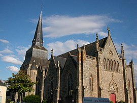
Saint-Herblain
Saint-Herblain | |
|---|---|
Commune | |
 | |
 Coat of arms | |
show Location of Saint-Herblain | |
 Saint-Herblain | |
| Coordinates: 47°12′44″N 1°38′59″W / 47.2122°N 1.6497°WCoordinates: 47°12′44″N 1°38′59″W / 47.2122°N 1.6497°W | |
| Country | France |
| Region | Pays de la Loire |
| Department | Loire-Atlantique |
| Arrondissement | Nantes |
| Canton | Saint-Herblain-1 and 2 |
| Intercommunality | Nantes Métropole |
| Government | |
| • Mayor (2020–2026) | Bertrand Affilé |
| Area 1 | 30.02 km2 (11.59 sq mi) |
| Population (Jan. 2018)[1] | 46,352 |
| • Density | 1,500/km2 (4,000/sq mi) |
| Time zone | UTC+01:00 (CET) |
| • Summer (DST) | UTC+02:00 (CEST) |
| INSEE/Postal code | 44162 /44800 |
| Elevation | 1–64 m (3.3–210.0 ft) |
| 1 French Land Register data, which excludes lakes, ponds, glaciers > 1 km2 (0.386 sq mi or 247 acres) and river estuaries. | |


Saint-Herblain (French pronunciation: [sɛ̃t‿ɛʁblɛ̃] (![]() listen); Breton: Sant-Ervlan, pronounced [ˈsãnt ɛrvlãn]) is a commune in the Loire-Atlantique department, administrative region of Pays de la Loire (Brittany as historical region), France.
listen); Breton: Sant-Ervlan, pronounced [ˈsãnt ɛrvlãn]) is a commune in the Loire-Atlantique department, administrative region of Pays de la Loire (Brittany as historical region), France.
It is the largest suburb of the city of Nantes, and lies adjacent to its west side.
History[]
The commune is named after the 7th-century AD Saint (French: Herblain and other names; Hermelandus in Breton and Latin), abbot and confessor under the Frankish king Chlothar III.
Population[]
|
| |||||||||||||||||||||||||||||||||||||||||||||||||||||||||||||||||||||||||||||||||||||||||||||||||||||||||||||||
| Source: EHESS[2] and INSEE (1968-2017)[3] | ||||||||||||||||||||||||||||||||||||||||||||||||||||||||||||||||||||||||||||||||||||||||||||||||||||||||||||||||
Breton language[]
In 2008, 0,36% of the children attended the bilingual schools in primary education. The school network in Breton Diwan has opened a college in Saint-Herblain, the first in the area.
Transport[]
The Gare de Basse-Indre-Saint-Herblain railway station is served by regional trains between Nantes and Saint-Nazaire.
Twin towns - sister cities[]
Saint-Herblain is twinned with:[4]
 Sankt Ingbert, Germany, since 1981
 Waterford City, Ireland, since 1986 where a housing estate is named after the suburb, St Herblain Park
 Viladecans, Spain, since 1991
 , Senegal
 Kazanlak, Bulgaria, since 2008
 Cleja, Romania
See also[]
- Communes of the Loire-Atlantique department
References[]
- ^ "Populations légales 2018". INSEE. 28 December 2020.
- ^ Des villages de Cassini aux communes d'aujourd'hui: Commune data sheet Saint-Herblain, EHESS. (in French)
- ^ Population en historique depuis 1968, INSEE
- ^ "Les relations internationales". saint-herblain.fr (in French). Saint-Herblain. Retrieved 2019-11-18.
External links[]
- Official website (in French)
| Wikimedia Commons has media related to Saint-Herblain. |
| show Authority control |
|---|
- Communes of Loire-Atlantique