Saint-Hilaire, Haute-Garonne
Saint-Hilaire | |
|---|---|
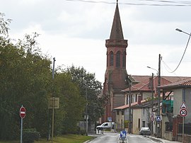 The church in Saint-Hilaire | |
 Coat of arms | |
show Location of Saint-Hilaire | |
 Saint-Hilaire | |
| Coordinates: 43°25′25″N 1°16′44″E / 43.4236°N 1.2789°ECoordinates: 43°25′25″N 1°16′44″E / 43.4236°N 1.2789°E | |
| Country | France |
| Region | Occitanie |
| Department | Haute-Garonne |
| Arrondissement | Muret |
| Canton | Muret |
| Intercommunality | Le Muretain Agglo |
| Government | |
| • Mayor (2020–2026) | André Morère |
| Area 1 | 6.33 km2 (2.44 sq mi) |
| Population (Jan. 2018)[1] | 1,282 |
| • Density | 200/km2 (520/sq mi) |
| Time zone | UTC+01:00 (CET) |
| • Summer (DST) | UTC+02:00 (CEST) |
| INSEE/Postal code | 31486 /31410 |
| Elevation | 175–198 m (574–650 ft) (avg. 182 m or 597 ft) |
| 1 French Land Register data, which excludes lakes, ponds, glaciers > 1 km2 (0.386 sq mi or 247 acres) and river estuaries. | |


Saint-Hilaire (French pronunciation: [sɛ̃.t‿ilɛʁ] (![]() listen); Occitan: Sent Alari) is a commune in the Haute-Garonne department in southwestern France.
listen); Occitan: Sent Alari) is a commune in the Haute-Garonne department in southwestern France.
Population[]
| Year | Pop. | ±% |
|---|---|---|
| 1962 | 234 | — |
| 1968 | 315 | +34.6% |
| 1975 | 389 | +23.5% |
| 1982 | 459 | +18.0% |
| 1990 | 504 | +9.8% |
| 1999 | 708 | +40.5% |
| 2008 | 1,070 | +51.1% |
| 2018 | 1,282 | +19.8% |
See also[]
References[]
- ^ "Populations légales 2018". INSEE. 28 December 2020.
| Wikimedia Commons has media related to Saint-Hilaire (Haute-Garonne). |
This Haute-Garonne geographical article is a stub. You can help Wikipedia by . |
Categories:
- Communes of Haute-Garonne
- Haute-Garonne geography stubs