Thonne-le-Thil
Thonne-le-Thil | |
|---|---|
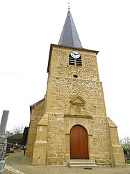 The church in Thonne-le-Thil | |
 Coat of arms | |
show Location of Thonne-le-Thil | |
 Thonne-le-Thil | |
| Coordinates: 49°34′19″N 5°21′00″E / 49.5719°N 5.35°ECoordinates: 49°34′19″N 5°21′00″E / 49.5719°N 5.35°E | |
| Country | France |
| Region | Grand Est |
| Department | Meuse |
| Arrondissement | Verdun |
| Canton | Montmédy |
| Intercommunality | |
| Government | |
| • Mayor (2020–2026) | François Montlibert[1] |
| Area 1 | 11.38 km2 (4.39 sq mi) |
| Population (Jan. 2018)[2] | 271 |
| • Density | 24/km2 (62/sq mi) |
| Time zone | UTC+01:00 (CET) |
| • Summer (DST) | UTC+02:00 (CEST) |
| INSEE/Postal code | 55509 /55600 |
| Elevation | 197–361 m (646–1,184 ft) (avg. 270 m or 890 ft) |
| 1 French Land Register data, which excludes lakes, ponds, glaciers > 1 km2 (0.386 sq mi or 247 acres) and river estuaries. | |


Thonne-le-Thil is a commune in the Meuse department in Grand Est in north-eastern France. The commune currently has around 250 inhabitants, although the population has steadily declined since a peak of nearly one thousand in the mid-1800s.
See also[]
References[]
- ^ "Répertoire national des élus: les maires". data.gouv.fr, Plateforme ouverte des données publiques françaises (in French). 2 December 2020.
- ^ "Populations légales 2018". INSEE. 28 December 2020.
| Wikimedia Commons has media related to Thonne-le-Thil. |
| show Authority control |
|---|
This Meuse geographical article is a stub. You can help Wikipedia by . |
Categories:
- Communes of Meuse (department)
- Meuse (department) geography stubs