Villard-Saint-Sauveur
Villard-Saint-Sauveur | |
|---|---|
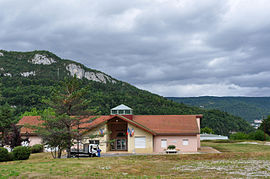 Town hall | |
show Location of Villard-Saint-Sauveur | |
 Villard-Saint-Sauveur | |
| Coordinates: 46°22′21″N 5°52′31″E / 46.3725°N 5.8753°ECoordinates: 46°22′21″N 5°52′31″E / 46.3725°N 5.8753°E | |
| Country | France |
| Region | Bourgogne-Franche-Comté |
| Department | Jura |
| Arrondissement | Saint-Claude |
| Canton | Coteaux du Lizon |
| Government | |
| • Mayor (2020–2026) | Daniel Monneret |
| Area 1 | 9.05 km2 (3.49 sq mi) |
| Population (Jan. 2018)[1] | 614 |
| • Density | 68/km2 (180/sq mi) |
| Time zone | UTC+01:00 (CET) |
| • Summer (DST) | UTC+02:00 (CEST) |
| INSEE/Postal code | 39560 /39200 |
| Elevation | 410–1,089 m (1,345–3,573 ft) |
| 1 French Land Register data, which excludes lakes, ponds, glaciers > 1 km2 (0.386 sq mi or 247 acres) and river estuaries. | |


Villard-Saint-Sauveur is a commune in the Jura department in the Bourgogne-Franche-Comté region in eastern France.
Population[]
|
|
See also[]
References[]
- ^ "Populations légales 2018". INSEE. 28 December 2020.
| Wikimedia Commons has media related to Villard-Saint-Sauveur. |
| show Authority control |
|---|
This Jura geographical article is a stub. You can help Wikipedia by . |
Categories:
- Communes of Jura (department)
- Jura (department) geography stubs