Évrecy
Évrecy | |
|---|---|
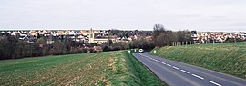 A general view of Évrecy | |
 Coat of arms | |
show Location of Évrecy | |
 Évrecy | |
| Coordinates: 49°06′02″N 0°30′07″W / 49.1006°N 0.5019°WCoordinates: 49°06′02″N 0°30′07″W / 49.1006°N 0.5019°W | |
| Country | France |
| Region | Normandy |
| Department | Calvados |
| Arrondissement | Caen |
| Canton | Évrecy |
| Government | |
| • Mayor (2020–2026) | Henri Girard |
| Area 1 | 8.31 km2 (3.21 sq mi) |
| Population (Jan. 2018)[1] | 2,000 |
| • Density | 240/km2 (620/sq mi) |
| Time zone | UTC+01:00 (CET) |
| • Summer (DST) | UTC+02:00 (CEST) |
| INSEE/Postal code | 14257 /14210 |
| Elevation | 58–122 m (190–400 ft) (avg. 110 m or 360 ft) |
| 1 French Land Register data, which excludes lakes, ponds, glaciers > 1 km2 (0.386 sq mi or 247 acres) and river estuaries. | |


show This article may be expanded with text translated from the corresponding article in French. (December 2008) Click [show] for important translation instructions. |
Évrecy (French pronunciation: [evʁəsi] (![]() listen)) is a commune in the Calvados department in the Normandy region in northwestern France.
listen)) is a commune in the Calvados department in the Normandy region in northwestern France.
Population[]
| Year | Pop. | ±% |
|---|---|---|
| 1962 | 607 | — |
| 1968 | 619 | +2.0% |
| 1975 | 828 | +33.8% |
| 1982 | 1,099 | +32.7% |
| 1990 | 1,093 | −0.5% |
| 1999 | 1,263 | +15.6% |
| 2008 | 1,557 | +23.3% |
See also[]
- Communes of the Calvados department
References[]
- ^ "Populations légales 2018". INSEE. 28 December 2020.
| Wikimedia Commons has media related to Évrecy. |
| show Communes of the Calvados department |
|---|
| show Authority control |
|---|
This Calvados geographical article is a stub. You can help Wikipedia by . |
Categories:
- Communes of Calvados (department)
- Calvados (department) geography stubs