Saint-Denis-de-Méré
show This article may be expanded with text translated from the corresponding article in French. (December 2008) Click [show] for important translation instructions. |
Saint-Denis-de-Méré | |
|---|---|
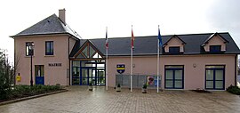 Town hall | |
 Coat of arms | |
show Location of Saint-Denis-de-Méré | |
 Saint-Denis-de-Méré | |
| Coordinates: 48°52′15″N 0°30′54″W / 48.8708°N 0.515°WCoordinates: 48°52′15″N 0°30′54″W / 48.8708°N 0.515°W | |
| Country | France |
| Region | Normandy |
| Department | Calvados |
| Arrondissement | Vire |
| Canton | Condé-sur-Noireau |
| Government | |
| • Mayor (2020–2026) | Manuel Machado |
| Area 1 | 11.37 km2 (4.39 sq mi) |
| Population (Jan. 2018)[1] | 806 |
| • Density | 71/km2 (180/sq mi) |
| Time zone | UTC+01:00 (CET) |
| • Summer (DST) | UTC+02:00 (CEST) |
| INSEE/Postal code | 14572 /14110 |
| Elevation | 57–208 m (187–682 ft) (avg. 200 m or 660 ft) |
| 1 French Land Register data, which excludes lakes, ponds, glaciers > 1 km2 (0.386 sq mi or 247 acres) and river estuaries. | |


Saint-Denis-de-Méré (French pronunciation: [sɛ̃ dəni də meʁe] (![]() listen)) is a commune in the Calvados department in the Normandy region in northwestern France.
listen)) is a commune in the Calvados department in the Normandy region in northwestern France.
Population[]
| Year | Pop. | ±% |
|---|---|---|
| 1962 | 656 | — |
| 1968 | 759 | +15.7% |
| 1975 | 820 | +8.0% |
| 1982 | 925 | +12.8% |
| 1990 | 835 | −9.7% |
| 1999 | 798 | −4.4% |
| 2008 | 828 | +3.8% |
See also[]
- Communes of the Calvados department
References[]
- ^ "Populations légales 2018". INSEE. 28 December 2020.
| Wikimedia Commons has media related to Saint-Denis-de-Méré. |
| show Communes of the Calvados department |
|---|
| show Authority control |
|---|
This Calvados geographical article is a stub. You can help Wikipedia by . |
Categories:
- Communes of Calvados (department)
- Calvados (department) geography stubs