Les Monts d'Aunay
Les Monts d'Aunay | |
|---|---|
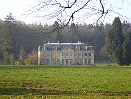 The chateau of La Ferrière | |
Location of Les Monts d'Aunay  | |
 Les Monts d'Aunay | |
| Coordinates: 49°01′12″N 0°37′55″W / 49.020°N 0.632°WCoordinates: 49°01′12″N 0°37′55″W / 49.020°N 0.632°W | |
| Country | France |
| Region | Normandy |
| Department | Calvados |
| Arrondissement | Vire |
| Canton | Les Monts d'Aunay |
| Intercommunality | |
| Government | |
| • Mayor (2020–2026) | Christine Salmon |
| Area 1 | 69.43 km2 (26.81 sq mi) |
| Population (Jan. 2018)[1] | 4,634 |
| • Density | 67/km2 (170/sq mi) |
| Time zone | UTC+01:00 (CET) |
| • Summer (DST) | UTC+02:00 (CEST) |
| INSEE/Postal code | 14027 /14260, 14770 |
| 1 French Land Register data, which excludes lakes, ponds, glaciers > 1 km2 (0.386 sq mi or 247 acres) and river estuaries. | |


Les Monts d'Aunay (French pronunciation: ��[le mɔ̃ donɛ]) is a commune in the department of Calvados, northwestern France. The municipality was established on 1 January 2017 by merger of the former communes of Aunay-sur-Odon (the seat), Bauquay, Campandré-Valcongrain, Danvou-la-Ferrière, Ondefontaine, Le Plessis-Grimoult and Roucamps.[2]
See also[]
- Communes of the Calvados department
References[]
| Wikimedia Commons has media related to Les Monts d'Aunay. |
- ^ "Populations légales 2018". The National Institute of Statistics and Economic Studies. 28 December 2020.
- ^ Arrêté préfectoral 26 September 2016 (in French)
Communes of the Calvados department | |
|---|---|
| Prefecture |
|
| Subprefectures |
|
| Other |
|
This Calvados geographical article is a stub. You can help Wikipedia by . |
Categories:
- Communes of Calvados (department)
- Calvados (department) geography stubs