Formigny La Bataille
Formigny La Bataille | |
|---|---|
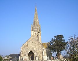 The church in Formigny La Bataille | |
Location of Formigny La Bataille  | |
 Formigny La Bataille | |
| Coordinates: 49°20′10″N 0°53′56″W / 49.336°N 0.899°WCoordinates: 49°20′10″N 0°53′56″W / 49.336°N 0.899°W | |
| Country | France |
| Region | Normandy |
| Department | Calvados |
| Arrondissement | Bayeux |
| Canton | Trévières |
| Intercommunality | CC Isigny-Omaha Intercom |
| Government | |
| • Mayor (2020–2026) | Alain Gervais |
| Area 1 | 26.24 km2 (10.13 sq mi) |
| Population (Jan. 2018)[1] | 734 |
| • Density | 28/km2 (72/sq mi) |
| Time zone | UTC+01:00 (CET) |
| • Summer (DST) | UTC+02:00 (CEST) |
| INSEE/Postal code | 14281 /14710 |
| 1 French Land Register data, which excludes lakes, ponds, glaciers > 1 km2 (0.386 sq mi or 247 acres) and river estuaries. | |


Formigny La Bataille (French pronunciation: [fɔʁmiɲi la bataj]) is a commune in the department of Calvados, northwestern France. The municipality was established on 1 January 2017 by merger of the former communes of Formigny (the seat), Aignerville, Écrammeville and Louvières.[2]
See also[]
- Communes of the Calvados department
References[]
| Wikimedia Commons has media related to Formigny La Bataille. |
- ^ "Populations légales 2018". The National Institute of Statistics and Economic Studies. 28 December 2020.
- ^ Arrêté préfectoral 8 September 2016 (in French)
Communes of the Calvados department | |
|---|---|
| Prefecture |
|
| Subprefectures |
|
| Other |
|
This Calvados geographical article is a stub. You can help Wikipedia by . |
Categories:
- Communes of Calvados (department)
- Populated places established in 2017
- 2017 establishments in France
- Calvados (department) geography stubs