Grentheville
show This article may be expanded with text translated from the corresponding article in French. (December 2008) Click [show] for important translation instructions. |
Grentheville | |
|---|---|
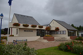 The town hall in Grentheville | |
show Location of Grentheville | |
 Grentheville | |
| Coordinates: 49°08′57″N 0°17′09″W / 49.1492°N 0.2858°WCoordinates: 49°08′57″N 0°17′09″W / 49.1492°N 0.2858°W | |
| Country | France |
| Region | Normandy |
| Department | Calvados |
| Arrondissement | Caen |
| Canton | Évrecy |
| Intercommunality | CU Caen la Mer |
| Government | |
| • Mayor (2008–2014) | Gilbert Bouhier |
| Area 1 | 4.08 km2 (1.58 sq mi) |
| Population (Jan. 2018)[1] | 955 |
| • Density | 230/km2 (610/sq mi) |
| Time zone | UTC+01:00 (CET) |
| • Summer (DST) | UTC+02:00 (CEST) |
| INSEE/Postal code | 14319 /14540 |
| Elevation | 22–33 m (72–108 ft) (avg. 25 m or 82 ft) |
| 1 French Land Register data, which excludes lakes, ponds, glaciers > 1 km2 (0.386 sq mi or 247 acres) and river estuaries. | |


Grentheville is a commune in the Calvados department in the Normandy region in northwestern France.
Population[]
| Year | Pop. | ±% |
|---|---|---|
| 1962 | 194 | — |
| 1968 | 224 | +15.5% |
| 1975 | 188 | −16.1% |
| 1982 | 311 | +65.4% |
| 1990 | 597 | +92.0% |
| 1999 | 753 | +26.1% |
| 2008 | 959 | +27.4% |
See also[]
- Communes of the Calvados department
References[]
- ^ "Populations légales 2018". INSEE. 28 December 2020.
| Wikimedia Commons has media related to Grentheville. |
| show Communes of the Calvados department |
|---|
This Calvados geographical article is a stub. You can help Wikipedia by . |
Categories:
- Communes of Calvados (department)
- Calvados (department) geography stubs