Valambray
Valambray | |
|---|---|
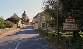 The road into Airan | |
Location of Valambray  | |
 Valambray | |
| Coordinates: 49°06′04″N 0°09′07″W / 49.101°N 0.152°WCoordinates: 49°06′04″N 0°09′07″W / 49.101°N 0.152°W | |
| Country | France |
| Region | Normandy |
| Department | Calvados |
| Arrondissement | Caen |
| Canton | Troarn |
| Intercommunality | Val ès dunes |
| Area 1 | 41.16 km2 (15.89 sq mi) |
| Population (Jan. 2018)[1] | 1,746 |
| • Density | 42/km2 (110/sq mi) |
| Time zone | UTC+01:00 (CET) |
| • Summer (DST) | UTC+02:00 (CEST) |
| INSEE/Postal code | 14005 /14370 |
| 1 French Land Register data, which excludes lakes, ponds, glaciers > 1 km2 (0.386 sq mi or 247 acres) and river estuaries. | |


Valambray is a commune in the department of Calvados, northwestern France. The municipality was established on 1 January 2017 by merger of the former communes of Airan (the seat), Billy, Conteville, Fierville-Bray and Poussy-la-Campagne.[2]
See also[]
- Communes of the Calvados department
References[]
| Wikimedia Commons has media related to Valambray. |
- ^ "Populations légales 2018". The National Institute of Statistics and Economic Studies. 28 December 2020.
- ^ Arrêté préfectoral 8 September 2016 (in French)
Communes of the Calvados department | |
|---|---|
| Prefecture |
|
| Subprefectures |
|
| Other |
|
This Calvados geographical article is a stub. You can help Wikipedia by . |
Categories:
- Communes of Calvados (department)
- Populated places established in 2017
- 2017 establishments in France
- Calvados (department) geography stubs