Mondrainville
Mondrainville | |
|---|---|
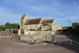 The church in Mondrainville | |
show Location of Mondrainville | |
 Mondrainville | |
| Coordinates: 49°08′22″N 0°30′57″W / 49.1394°N 0.5158°WCoordinates: 49°08′22″N 0°30′57″W / 49.1394°N 0.5158°W | |
| Country | France |
| Region | Normandy |
| Department | Calvados |
| Arrondissement | Caen |
| Canton | Évrecy |
| Intercommunality | Vallées de l'Orne et de l'Odon |
| Government | |
| • Mayor (2008–2014) | Jean-Louis Le Goff |
| Area 1 | 3.17 km2 (1.22 sq mi) |
| Population (Jan. 2018)[1] | 534 |
| • Density | 170/km2 (440/sq mi) |
| Time zone | UTC+01:00 (CET) |
| • Summer (DST) | UTC+02:00 (CEST) |
| INSEE/Postal code | 14438 /14210 |
| Elevation | 43–104 m (141–341 ft) (avg. 120 m or 390 ft) |
| 1 French Land Register data, which excludes lakes, ponds, glaciers > 1 km2 (0.386 sq mi or 247 acres) and river estuaries. | |


show This article may be expanded with text translated from the corresponding article in French. (December 2008) Click [show] for important translation instructions. |
Mondrainville is a commune in the Calvados department in the Normandy région in northwestern France.
Population[]
| Year | Pop. | ±% |
|---|---|---|
| 1962 | 145 | — |
| 1968 | 120 | −17.2% |
| 1975 | 144 | +20.0% |
| 1982 | 228 | +58.3% |
| 1990 | 315 | +38.2% |
| 1999 | 409 | +29.8% |
| 2008 | 442 | +8.1% |
See also[]
- Communes of the Calvados department
References[]
- ^ "Populations légales 2018". INSEE. 28 December 2020.
| Wikimedia Commons has media related to Mondrainville. |
| show Communes of the Calvados department |
|---|
This Calvados geographical article is a stub. You can help Wikipedia by . |
Categories:
- Communes of Calvados (department)
- Calvados (department) geography stubs