Allières
Allières | |
|---|---|
Commune | |
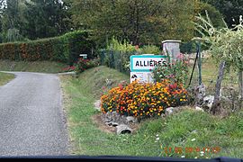 The road into Allières | |
Location of Allières  | |
 Allières | |
| Coordinates: 43°02′14″N 1°22′00″E / 43.0372°N 1.3667°ECoordinates: 43°02′14″N 1°22′00″E / 43.0372°N 1.3667°E | |
| Country | France |
| Region | Occitanie |
| Department | Ariège |
| Arrondissement | Saint-Girons |
| Canton | Couserans Est |
| Intercommunality | |
| Government | |
| • Mayor (2020–2026) | Denis Puech |
| Area 1 | 9.1 km2 (3.5 sq mi) |
| Population (Jan. 2018)[1] | 72 |
| • Density | 7.9/km2 (20/sq mi) |
| Time zone | UTC+01:00 (CET) |
| • Summer (DST) | UTC+02:00 (CEST) |
| INSEE/Postal code | 09007 /09240 |
| Elevation | 347–652 m (1,138–2,139 ft) (avg. 550 m or 1,800 ft) |
| 1 French Land Register data, which excludes lakes, ponds, glaciers > 1 km2 (0.386 sq mi or 247 acres) and river estuaries. | |


Allières (French pronunciation: [aljɛʁ]; Occitan: Alhèras) is a commune in the Ariège department in the Occitanie region of southwestern France.
The inhabitants of the commune are known as Alliérasois or Alliérasoises[2]
Geography[]
Allières is located in the Plantaurel mountains in the Natural Regional Park of Pyrénées ariégeoises some 22 km west by north-west of Foix and some 70 km south of Toulouse. Access to the commune is by the minor D49 road which runs north from the D117 road through the commune and the village and continuing north across the mountains to join the D119 near Maury. There is also access by a minor road from the east. Apart from the village there is also the hamlet of Escougnale. The commune is heavily forested with a few farms.[3]
Numerous streams rise in the commune mostly flowing north to the Ruisseau de Mourisse which forms the northern border of the commune and flows west to join the Arize river near Maury. There is also the Ruisseau de Peydalières rising in the west of the commune which flows west also to join the Arize.[3]
Neighbouring communes and villages[]
Places adjacent to Allières | |
|---|---|
Administration[]
This list is incomplete; you can help by . (April 2021) |
List of Successive Mayors[4]
| From | To | Name |
|---|---|---|
| 2001 | 2026 | Denis Puech |
Population[]
| Year | Pop. | ±% |
|---|---|---|
| 2005 | 68 | — |
| 2006 | 66 | −2.9% |
| 2007 | 65 | −1.5% |
| 2008 | 63 | −3.1% |
| 2009 | 62 | −1.6% |
| 2010 | 61 | −1.6% |
| 2011 | 69 | +13.1% |
| 2012 | 71 | +2.9% |
| 2013 | 71 | +0.0% |
| 2014 | 71 | +0.0% |
| 2015 | 71 | +0.0% |
| 2016 | 71 | +0.0% |


Culture and heritage[]
Religious heritage[]
The Parish Church of Saint Roche contains two items that are registered as historical objects:
- A Painting with frame: Presentation at the temple of the child Jesus with a saint bishop (17th century)
 [5]
[5] - A Painting with frame: Virgin and child surrounded by Saint Julien and Saint Nicolas de Myre (1871)[6]
Notable people linked to the commune[]
The Falentin Saintenac family has many dead in their chapel adjoining the church.
See also[]
- Communes of the Ariège department
- Cantons of the Ariège department
- Arrondissements of the Ariège department
External links[]
- Allières on the National Geographic Institute website (in French)
- Allières on Lion1906
- Allières on Géoportail, National Geographic Institute (IGN) website (in French)
- Ailleres on the 1750 Cassini Map
References[]
- ^ "Populations légales 2018". The National Institute of Statistics and Economic Studies. 28 December 2020.
- ^ Inhabitants of Ariège (in French)
- ^ a b c Google Maps
- ^ List of Mayors of France
- ^ Ministry of Culture, Palissy IM09000116 Painting with frame: Presentation at the temple of the child Jesus with a saint bishop (in French)
- ^ Ministry of Culture, Palissy IM09000115 Painting with frame: Virgin and child surrounded by Saint Julien and Saint Nicolas de Myre (in French)
| Wikimedia Commons has media related to Allières. |
- Communes of Ariège (department)