Engomer
This article may be expanded with text translated from the corresponding article in French. (December 2008) Click [show] for important translation instructions.
|
Engomer | |
|---|---|
Commune | |
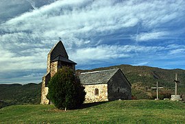 The chapel in Engomer | |
Location of Engomer  | |
 Engomer | |
| Coordinates: 42°56′51″N 1°03′37″E / 42.9475°N 1.0603°ECoordinates: 42°56′51″N 1°03′37″E / 42.9475°N 1.0603°E | |
| Country | France |
| Region | Occitanie |
| Department | Ariège |
| Arrondissement | Saint-Girons |
| Canton | Couserans Ouest |
| Government | |
| • Mayor (2020–2026) | Jean-Claude Le Hir[1] |
| Area 1 | 7.6 km2 (2.9 sq mi) |
| Population (Jan. 2018)[2] | 300 |
| • Density | 39/km2 (100/sq mi) |
| Time zone | UTC+01:00 (CET) |
| • Summer (DST) | UTC+02:00 (CEST) |
| INSEE/Postal code | 09111 /09800 |
| Elevation | 448–1,120 m (1,470–3,675 ft) (avg. 462 m or 1,516 ft) |
| 1 French Land Register data, which excludes lakes, ponds, glaciers > 1 km2 (0.386 sq mi or 247 acres) and river estuaries. | |


Engomer is a commune in the Ariège department in southwestern France.
Population[]
Inhabitants are called Engomerois.
| Year | Pop. | ±% |
|---|---|---|
| 1962 | 286 | — |
| 1968 | 326 | +14.0% |
| 1975 | 318 | −2.5% |
| 1982 | 321 | +0.9% |
| 1990 | 293 | −8.7% |
| 1999 | 257 | −12.3% |
| 2008 | 275 | +7.0% |
See also[]
References[]
- ^ "Répertoire national des élus: les maires". data.gouv.fr, Plateforme ouverte des données publiques françaises (in French). 9 August 2021.
- ^ "Populations légales 2018". The National Institute of Statistics and Economic Studies. 28 December 2020.
| Wikimedia Commons has media related to Engomer. |
This Ariège geographical article is a stub. You can help Wikipedia by . |
Categories:
- Communes of Ariège (department)
- Ariège (department) geography stubs