Lesparrou
This article may be expanded with text translated from the corresponding article in French. (December 2008) Click [show] for important translation instructions.
|
Lesparrou | |
|---|---|
Commune | |
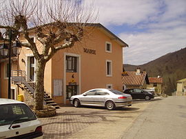 The town hall in Lesparrou | |
 Coat of arms | |
Location of Lesparrou  | |
 Lesparrou | |
| Coordinates: 42°55′53″N 1°54′19″E / 42.9314°N 1.9053°ECoordinates: 42°55′53″N 1°54′19″E / 42.9314°N 1.9053°E | |
| Country | France |
| Region | Occitanie |
| Department | Ariège |
| Arrondissement | Pamiers |
| Canton | Pays d'Olmes |
| Intercommunality | Pays d'Olmes |
| Government | |
| • Mayor (2020–2026) | Pascale Audouy |
| Area 1 | 16.09 km2 (6.21 sq mi) |
| Population (Jan. 2018)[1] | 233 |
| • Density | 14/km2 (38/sq mi) |
| Time zone | UTC+01:00 (CET) |
| • Summer (DST) | UTC+02:00 (CEST) |
| INSEE/Postal code | 09165 /09300 |
| Elevation | 440–761 m (1,444–2,497 ft) (avg. 450 m or 1,480 ft) |
| 1 French Land Register data, which excludes lakes, ponds, glaciers > 1 km2 (0.386 sq mi or 247 acres) and river estuaries. | |


Lesparrou (French pronunciation: [lɛspaʁu]; Occitan: L'Esparron) is a commune in the Ariège department in southwestern France.
Population[]
| Year | Pop. | ±% |
|---|---|---|
| 1962 | 316 | — |
| 1968 | 387 | +22.5% |
| 1975 | 366 | −5.4% |
| 1982 | 291 | −20.5% |
| 1990 | 290 | −0.3% |
| 1999 | 265 | −8.6% |
| 2008 | 243 | −8.3% |
See also[]
References[]
- ^ "Populations légales 2018". The National Institute of Statistics and Economic Studies. 28 December 2020.
| Wikimedia Commons has media related to Lesparrou. |
This Ariège geographical article is a stub. You can help Wikipedia by . |
Categories:
- Communes of Ariège (department)
- Ariège (department) geography stubs