Baupte
Baupte | |
|---|---|
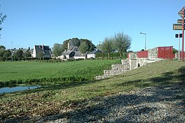 Baupte from the bridge over the Sèves | |
show Location of Baupte | |
 Baupte | |
| Coordinates: 49°18′32″N 1°21′36″W / 49.3089°N 1.36°WCoordinates: 49°18′32″N 1°21′36″W / 49.3089°N 1.36°W | |
| Country | France |
| Region | Normandy |
| Department | Manche |
| Arrondissement | Coutances |
| Canton | Carentan-les-Marais |
| Intercommunality | Baie du Cotentin |
| Government | |
| • Mayor (2020–2026) | Daniel Thomas[1] |
| Area 1 | 2.29 km2 (0.88 sq mi) |
| Population (Jan. 2018)[2] | 430 |
| • Density | 190/km2 (490/sq mi) |
| Time zone | UTC+01:00 (CET) |
| • Summer (DST) | UTC+02:00 (CEST) |
| INSEE/Postal code | 50036 /50500 |
| Elevation | 2–26 m (6.6–85.3 ft) (avg. 20 m or 66 ft) |
| 1 French Land Register data, which excludes lakes, ponds, glaciers > 1 km2 (0.386 sq mi or 247 acres) and river estuaries. | |


Baupte is a commune in the Manche department in the Normandy region in northwestern France.
Population[]
|
|
See also[]
- Communes of the Manche department
References[]
- ^ "Répertoire national des élus: les maires". data.gouv.fr, Plateforme ouverte des données publiques françaises (in French). 2 December 2020.
- ^ "Populations légales 2018". INSEE. 28 December 2020.
| Wikimedia Commons has media related to Baupte. |
| show Communes of Manche |
|---|
| show Authority control |
|---|
This Manche geographical article is a stub. You can help Wikipedia by . |
Categories:
- Communes of Manche
- Manche geography stubs