Beauficel
Beauficel | |
|---|---|
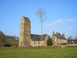 The church of Saint-Pierre | |
show Location of Beauficel | |
 Beauficel | |
| Coordinates: 48°44′27″N 0°57′32″W / 48.7408°N 0.9589°WCoordinates: 48°44′27″N 0°57′32″W / 48.7408°N 0.9589°W | |
| Country | France |
| Region | Normandy |
| Department | Manche |
| Arrondissement | Avranches |
| Canton | Le Mortainais |
| Intercommunality | CA Mont-Saint-Michel-Normandie |
| Government | |
| • Mayor (2020–2026) | Martine Herbert |
| Area 1 | 9.13 km2 (3.53 sq mi) |
| Population (Jan. 2018)[1] | 126 |
| • Density | 14/km2 (36/sq mi) |
| Time zone | UTC+01:00 (CET) |
| • Summer (DST) | UTC+02:00 (CEST) |
| INSEE/Postal code | 50040 /50150 |
| Elevation | 113–357 m (371–1,171 ft) |
| 1 French Land Register data, which excludes lakes, ponds, glaciers > 1 km2 (0.386 sq mi or 247 acres) and river estuaries. | |


Beauficel (French pronunciation: [bofisɛl]) is a commune in the Manche department in the Normandy region in northwestern France.
Population[]
|
|
See also[]
- Communes of the Manche department
References[]
- ^ "Populations légales 2018". INSEE. 28 December 2020.
| Wikimedia Commons has media related to Beauficel. |
| show Communes of Manche |
|---|
This Manche geographical article is a stub. You can help Wikipedia by . |
Categories:
- Communes of Manche
- Manche geography stubs