Belforêt-en-Perche
Belforêt-en-Perche | |
|---|---|
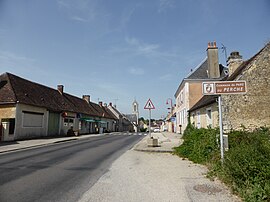 A road in Le Gué-de-la-Chaîne | |
Location of Belforêt-en-Perche  | |
 Belforêt-en-Perche | |
| Coordinates: 48°22′30″N 0°31′23″E / 48.375°N 0.523°ECoordinates: 48°22′30″N 0°31′23″E / 48.375°N 0.523°E | |
| Country | France |
| Region | Normandy |
| Department | Orne |
| Arrondissement | Mortagne-au-Perche |
| Canton | Ceton |
| Intercommunality | Collines du Perche normand |
| Government | |
| • Mayor (2020–2026) | David Boulay |
| Area 1 | 74.53 km2 (28.78 sq mi) |
| Population (Jan. 2018)[1] | 1,621 |
| • Density | 22/km2 (56/sq mi) |
| Time zone | UTC+01:00 (CET) |
| • Summer (DST) | UTC+02:00 (CEST) |
| INSEE/Postal code | 61196 /61130 |
| 1 French Land Register data, which excludes lakes, ponds, glaciers > 1 km2 (0.386 sq mi or 247 acres) and river estuaries. | |


Belforêt-en-Perche (French pronunciation: [bɛlfɔʁɛ ɑ̃ pɛʁʃ], literally Belforêt in Perche) is a commune in the department of Orne, northwestern France. The municipality was established on 1 January 2017 by merger of the former communes of Le Gué-de-la-Chaîne (the seat), Eperrais, Origny-le-Butin, La Perrière, Saint-Ouen-de-la-Cour and Sérigny.[2]
See also[]
- Communes of the Orne department
References[]
| Wikimedia Commons has media related to Belforêt-en-Perche. |
- ^ "Populations légales 2018". The National Institute of Statistics and Economic Studies. 28 December 2020.
- ^ Arrêté préfectoral 8 August 2016 (in French)
This Orne geographical article is a stub. You can help Wikipedia by . |
Categories:
- Communes of Orne
- Orne geography stubs