Hauterive, Orne
Hauterive | |
|---|---|
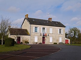 The town hall in Hauterive | |
show Location of Hauterive | |
 Hauterive | |
| Coordinates: 48°28′42″N 0°12′02″E / 48.4783°N 0.2006°ECoordinates: 48°28′42″N 0°12′02″E / 48.4783°N 0.2006°E | |
| Country | France |
| Region | Normandy |
| Department | Orne |
| Arrondissement | Alençon |
| Canton | Écouves |
| Intercommunality | Vallée de la Haute Sarthe |
| Government | |
| • Mayor (2014–2020) | Bruno Libert |
| Area 1 | 6.98 km2 (2.69 sq mi) |
| Population (Jan. 2018)[1] | 466 |
| • Density | 67/km2 (170/sq mi) |
| Time zone | UTC+01:00 (CET) |
| • Summer (DST) | UTC+02:00 (CEST) |
| INSEE/Postal code | 61202 /61250 |
| Elevation | 132–160 m (433–525 ft) (avg. 145 m or 476 ft) |
| 1 French Land Register data, which excludes lakes, ponds, glaciers > 1 km2 (0.386 sq mi or 247 acres) and river estuaries. | |


Hauterive is a commune in the Orne department in north-western France.
See also[]
- Communes of the Orne department
- Parc naturel régional Normandie-Maine
References[]
- ^ "Populations légales 2018". INSEE. 28 December 2020.
| Wikimedia Commons has media related to Hauterive (Orne). |
| show Communes of the Orne department |
|---|
This Orne geographical article is a stub. You can help Wikipedia by . |
Categories:
- Communes of Orne
- Orne geography stubs