Champ-Haut
Champ-Haut | |
|---|---|
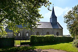 The church in Champ-Haut | |
show Location of Champ-Haut | |
 Champ-Haut | |
| Coordinates: 48°43′39″N 0°19′33″E / 48.7275°N 0.3258°ECoordinates: 48°43′39″N 0°19′33″E / 48.7275°N 0.3258°E | |
| Country | France |
| Region | Normandy |
| Department | Orne |
| Arrondissement | Mortagne-au-Perche |
| Canton | Rai |
| Intercommunality | Vallées d'Auge et du Merlerault |
| Government | |
| • Mayor (2020–2026) | André Allain[1] |
| Area 1 | 5.16 km2 (1.99 sq mi) |
| Population (Jan. 2018)[2] | 48 |
| • Density | 9.3/km2 (24/sq mi) |
| Demonym(s) | Campo-Haltiens |
| Time zone | UTC+01:00 (CET) |
| • Summer (DST) | UTC+02:00 (CEST) |
| INSEE/Postal code | 61088 /61240 |
| Elevation | 220–321 m (722–1,053 ft) (avg. 321 m or 1,053 ft) |
| 1 French Land Register data, which excludes lakes, ponds, glaciers > 1 km2 (0.386 sq mi or 247 acres) and river estuaries. | |


Champ-Haut (French pronunciation: [ʃɑ̃ o] (![]() listen)) is a commune in the Orne department in north-western France.
listen)) is a commune in the Orne department in north-western France.
See also[]
- Communes of the Orne department
References[]
- ^ "Répertoire national des élus: les maires". data.gouv.fr, Plateforme ouverte des données publiques françaises (in French). 2 December 2020.
- ^ "Populations légales 2018". INSEE. 28 December 2020.
| Wikimedia Commons has media related to Champ-Haut. |
| show Communes of the Orne department |
|---|
This Orne geographical article is a stub. You can help Wikipedia by . |
Categories:
- Communes of Orne
- Orne geography stubs