Tourouvre au Perche
Tourouvre au Perche | |
|---|---|
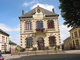 The town hall in Tourouvre au Perche | |
Location of Tourouvre au Perche  | |
 Tourouvre au Perche | |
| Coordinates: 48°35′24″N 0°39′07″E / 48.590°N 0.652°ECoordinates: 48°35′24″N 0°39′07″E / 48.590°N 0.652°E | |
| Country | France |
| Region | Normandy |
| Department | Orne |
| Arrondissement | Mortagne-au-Perche |
| Canton | Tourouvre au Perche |
| Intercommunality | |
| Government | |
| • Mayor (2020-2026) | Franck Poirier |
| Area 1 | 93.76 km2 (36.20 sq mi) |
| Population (Jan. 2018)[1] | 3,115 |
| • Density | 33/km2 (86/sq mi) |
| Time zone | UTC+01:00 (CET) |
| • Summer (DST) | UTC+02:00 (CEST) |
| INSEE/Postal code | 61491 /61190 |
| 1 French Land Register data, which excludes lakes, ponds, glaciers > 1 km2 (0.386 sq mi or 247 acres) and river estuaries. | |


Tourouvre au Perche is a commune in the department of Orne, northwestern France. The municipality was established on 1 January 2016 by merger of the former communes of Autheuil, Bivilliers, Bresolettes, Bubertré, Champs, Lignerolles, La Poterie-au-Perche, Prépotin, Randonnai and Tourouvre (the seat).[2]
Wattway[]
On 22 December 2016, the world's first solar-panel road - the Wattway on the RD5 road - was inaugurated. It was covered with 2,800 square meters of electricity-generating panels. The panels are covered with a resin containing fine sheets of silicon, making them tough enough to withstand all traffic. The project cost 5m Euros. On 22 July 2019 it was reported to be a colossal failure.[3]
See also[]
- Communes of the Orne department
References[]
| Wikimedia Commons has media related to Tourouvre au Perche. |
- ^ "Populations légales 2018". The National Institute of Statistics and Economic Studies. 28 December 2020.
- ^ Arrêté préfectoral 21 December 2015 (in French)
- ^ [1] 22 July 2019 (in French)
This Orne geographical article is a stub. You can help Wikipedia by . |
- Communes of Orne
- Populated places established in 2016
- 2016 establishments in France
- Perche
- Orne geography stubs