Dompierre, Orne
Dompierre | |
|---|---|
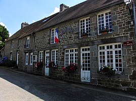 The town hall in Dompierre | |
show Location of Dompierre | |
 Dompierre | |
| Coordinates: 48°37′59″N 0°33′03″W / 48.6331°N 0.5508°WCoordinates: 48°37′59″N 0°33′03″W / 48.6331°N 0.5508°W | |
| Country | France |
| Region | Normandy |
| Department | Orne |
| Arrondissement | Argentan |
| Canton | La Ferté-Macé |
| Intercommunality | Flers Agglo |
| Government | |
| • Mayor (2020–2026) | Daniel Bigeon[1] |
| Area 1 | 8.56 km2 (3.31 sq mi) |
| Population (Jan. 2018)[2] | 402 |
| • Density | 47/km2 (120/sq mi) |
| Time zone | UTC+01:00 (CET) |
| • Summer (DST) | UTC+02:00 (CEST) |
| INSEE/Postal code | 61146 /61700 |
| Elevation | 172–257 m (564–843 ft) (avg. 220 m or 720 ft) |
| 1 French Land Register data, which excludes lakes, ponds, glaciers > 1 km2 (0.386 sq mi or 247 acres) and river estuaries. | |


Dompierre is a commune in the Orne department in north-western France.
See also[]
- Communes of the Orne department
- Parc naturel régional Normandie-Maine
References[]
- ^ "Répertoire national des élus: les maires". data.gouv.fr, Plateforme ouverte des données publiques françaises (in French). 2 December 2020.
- ^ "Populations légales 2018". INSEE. 28 December 2020.
| Wikimedia Commons has media related to Dompierre (Orne). |
| show Communes of the Orne department |
|---|
| show Authority control |
|---|
This Orne geographical article is a stub. You can help Wikipedia by . |
Categories:
- Communes of Orne
- Orne geography stubs