Le Ménil-Bérard
Le Ménil-Bérard | |
|---|---|
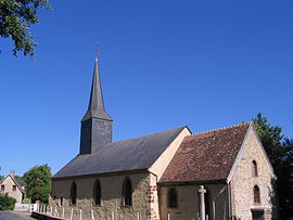 The church in Le Ménil-Bérard | |
show Location of Le Ménil-Bérard | |
 Le Ménil-Bérard | |
| Coordinates: 48°42′36″N 0°30′44″E / 48.71°N 0.5122°ECoordinates: 48°42′36″N 0°30′44″E / 48.71°N 0.5122°E | |
| Country | France |
| Region | Normandy |
| Department | Orne |
| Arrondissement | Mortagne-au-Perche |
| Canton | Tourouvre au Perche |
| Intercommunality | Pays de L'Aigle |
| Government | |
| • Mayor (2008–2014) | Pascal Gadeyne |
| Area 1 | 7.33 km2 (2.83 sq mi) |
| Population (Jan. 2018)[1] | 75 |
| • Density | 10/km2 (27/sq mi) |
| Time zone | UTC+01:00 (CET) |
| • Summer (DST) | UTC+02:00 (CEST) |
| INSEE/Postal code | 61259 /61270 |
| Elevation | 228–287 m (748–942 ft) (avg. 248 m or 814 ft) |
| 1 French Land Register data, which excludes lakes, ponds, glaciers > 1 km2 (0.386 sq mi or 247 acres) and river estuaries. | |


Le Ménil-Bérard is a commune in the Orne department in north-western France.
See also[]
- Communes of the Orne department
References[]
- ^ "Populations légales 2018". INSEE. 28 December 2020.
| Wikimedia Commons has media related to Le Ménil-Bérard. |
| show Communes of the Orne department |
|---|
This Orne geographical article is a stub. You can help Wikipedia by . |
Categories:
- Communes of Orne
- Orne geography stubs