Mahéru
Mahéru | |
|---|---|
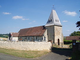 The church in Mahéru | |
Location of Mahéru  | |
 Mahéru | |
| Coordinates: 48°39′29″N 0°25′59″E / 48.6581°N 0.4331°ECoordinates: 48°39′29″N 0°25′59″E / 48.6581°N 0.4331°E | |
| Country | France |
| Region | Normandy |
| Department | Orne |
| Arrondissement | Mortagne-au-Perche |
| Canton | Rai |
| Intercommunality | Pays de L'Aigle |
| Government | |
| • Mayor (2020–2026) | François Hurel[1] |
| Area 1 | 19.63 km2 (7.58 sq mi) |
| Population (Jan. 2018)[2] | 268 |
| • Density | 14/km2 (35/sq mi) |
| Time zone | UTC+01:00 (CET) |
| • Summer (DST) | UTC+02:00 (CEST) |
| INSEE/Postal code | 61244 /61380 |
| Elevation | 172–314 m (564–1,030 ft) (avg. 277 m or 909 ft) |
| 1 French Land Register data, which excludes lakes, ponds, glaciers > 1 km2 (0.386 sq mi or 247 acres) and river estuaries. | |


Mahéru (French pronunciation: [ma.eʁy] (![]() listen)) is a commune in the Orne department in north-western France.
listen)) is a commune in the Orne department in north-western France.
See also[]
- Communes of the Orne department
References[]
- ^ "Répertoire national des élus: les maires". data.gouv.fr, Plateforme ouverte des données publiques françaises (in French). 9 August 2021.
- ^ "Populations légales 2018". The National Institute of Statistics and Economic Studies. 28 December 2020.
| Wikimedia Commons has media related to Mahéru. |
This Orne geographical article is a stub. You can help Wikipedia by . |
Categories:
- Communes of Orne
- Orne geography stubs