Chanu
Chanu | |
|---|---|
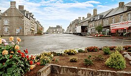 The centre of Chanu | |
show Location of Chanu | |
 Chanu | |
| Coordinates: 48°43′46″N 0°40′35″W / 48.7294°N 0.6764°WCoordinates: 48°43′46″N 0°40′35″W / 48.7294°N 0.6764°W | |
| Country | France |
| Region | Normandy |
| Department | Orne |
| Arrondissement | Argentan |
| Canton | Domfront en Poiraie |
| Intercommunality | Domfront Tinchebray Interco |
| Government | |
| • Mayor (2008–2014) | Thierry Aubin |
| Area 1 | 15.72 km2 (6.07 sq mi) |
| Population (Jan. 2018)[1] | 1,261 |
| • Density | 80/km2 (210/sq mi) |
| Demonym(s) | Chanusiens |
| Time zone | UTC+01:00 (CET) |
| • Summer (DST) | UTC+02:00 (CEST) |
| INSEE/Postal code | 61093 /61800 |
| Elevation | 226–321 m (741–1,053 ft) (avg. 299 m or 981 ft) |
| Website | www.chanu.eu |
| 1 French Land Register data, which excludes lakes, ponds, glaciers > 1 km2 (0.386 sq mi or 247 acres) and river estuaries. | |


Chanu is a commune in the Orne department in north-western France.
See also[]
- Communes of the Orne department
References[]
- ^ "Populations légales 2018". INSEE. 28 December 2020.
| Wikimedia Commons has media related to Chanu. |
| show Communes of the Orne department |
|---|
This Orne geographical article is a stub. You can help Wikipedia by . |
Categories:
- Communes of Orne
- Orne geography stubs