Le Bouillon
Le Bouillon | |
|---|---|
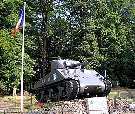 A Sherman tank at the cross of Médavy | |
show Location of Le Bouillon | |
 Le Bouillon | |
| Coordinates: 48°33′44″N 0°06′15″E / 48.5622°N 0.1042°ECoordinates: 48°33′44″N 0°06′15″E / 48.5622°N 0.1042°E | |
| Country | France |
| Region | Normandy |
| Department | Orne |
| Arrondissement | Alençon |
| Canton | Sées |
| Government | |
| • Mayor (2020–2026) | Élisabeth Mesne |
| Area 1 | 17.77 km2 (6.86 sq mi) |
| Population (Jan. 2018)[1] | 169 |
| • Density | 9.5/km2 (25/sq mi) |
| Time zone | UTC+01:00 (CET) |
| • Summer (DST) | UTC+02:00 (CEST) |
| INSEE/Postal code | 61056 /61500 |
| Elevation | 197–393 m (646–1,289 ft) (avg. 400 m or 1,300 ft) |
| 1 French Land Register data, which excludes lakes, ponds, glaciers > 1 km2 (0.386 sq mi or 247 acres) and river estuaries. | |


Le Bouillon (French pronunciation: [lə bujɔ̃]) is a commune in the Orne department in northwestern France.
Population[]
| Year | Pop. | ±% |
|---|---|---|
| 1962 | 146 | — |
| 1968 | 154 | +5.5% |
| 1975 | 158 | +2.6% |
| 1982 | 138 | −12.7% |
| 1990 | 156 | +13.0% |
| 1999 | 151 | −3.2% |
| 2006 | 145 | −4.0% |
| 2008 | 141 | −2.8% |
See also[]
- Communes of the Orne department
- Parc naturel régional Normandie-Maine
References[]
- ^ "Populations légales 2018". INSEE. 28 December 2020.
| Wikimedia Commons has media related to Le Bouillon. |
| show Communes of the Orne department |
|---|
This Orne geographical article is a stub. You can help Wikipedia by . |
Categories:
- Communes of Orne
- Orne geography stubs