La Ferrière-Bochard
La Ferrière-Bochard | |
|---|---|
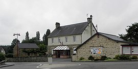 The town hall in La Ferrière-Bochard | |
show Location of La Ferrière-Bochard | |
 La Ferrière-Bochard | |
| Coordinates: 48°24′53″N 0°01′50″W / 48.4147°N 0.0306°WCoordinates: 48°24′53″N 0°01′50″W / 48.4147°N 0.0306°W | |
| Country | France |
| Region | Normandy |
| Department | Orne |
| Arrondissement | Alençon |
| Canton | Damigny |
| Intercommunality | Communauté urbaine d'Alençon |
| Government | |
| • Mayor (2020–2026) | Patrick Joubert |
| Area 1 | 10.82 km2 (4.18 sq mi) |
| Population (Jan. 2018)[1] | 744 |
| • Density | 69/km2 (180/sq mi) |
| Time zone | UTC+01:00 (CET) |
| • Summer (DST) | UTC+02:00 (CEST) |
| INSEE/Postal code | 61165 /61420 |
| Elevation | 133–210 m (436–689 ft) (avg. 150 m or 490 ft) |
| 1 French Land Register data, which excludes lakes, ponds, glaciers > 1 km2 (0.386 sq mi or 247 acres) and river estuaries. | |


La Ferrière-Bochard (French pronunciation: [la fɛʁjɛʁ bɔʃaʁ]) is a commune in the Orne department in north-western France.
See also[]
- Communes of the Orne department
- Parc naturel régional Normandie-Maine
References[]
- ^ "Populations légales 2018". INSEE. 28 December 2020.
| Wikimedia Commons has media related to La Ferrière-Bochard. |
| show Communes of the Orne department |
|---|
| show Authority control |
|---|
This Orne geographical article is a stub. You can help Wikipedia by . |
Categories:
- Communes of Orne
- Orne geography stubs