Le Ménil-Ciboult
Le Ménil-Ciboult | |
|---|---|
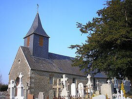 The church in Le Ménil-Ciboult | |
show Location of Le Ménil-Ciboult | |
 Le Ménil-Ciboult | |
| Coordinates: 48°45′54″N 0°47′20″W / 48.765°N 0.7889°WCoordinates: 48°45′54″N 0°47′20″W / 48.765°N 0.7889°W | |
| Country | France |
| Region | Normandy |
| Department | Orne |
| Arrondissement | Argentan |
| Canton | Domfront en Poiraie |
| Intercommunality | Domfront Tinchebray Interco |
| Government | |
| • Mayor (2008–2014) | Maurice Lebrun |
| Area 1 | 6.31 km2 (2.44 sq mi) |
| Population (Jan. 2018)[1] | 114 |
| • Density | 18/km2 (47/sq mi) |
| Time zone | UTC+01:00 (CET) |
| • Summer (DST) | UTC+02:00 (CEST) |
| INSEE/Postal code | 61262 /61800 |
| Elevation | 245–322 m (804–1,056 ft) |
| 1 French Land Register data, which excludes lakes, ponds, glaciers > 1 km2 (0.386 sq mi or 247 acres) and river estuaries. | |


Le Ménil-Ciboult is a commune in the Orne department in north-western France.
See also[]
- Communes of the Orne department
References[]
- ^ "Populations légales 2018". INSEE. 28 December 2020.
| Wikimedia Commons has media related to Le Ménil-Ciboult. |
| show Communes of the Orne department |
|---|
This Orne geographical article is a stub. You can help Wikipedia by . |
Categories:
- Communes of Orne
- Orne geography stubs