Breuville
Breuville | |
|---|---|
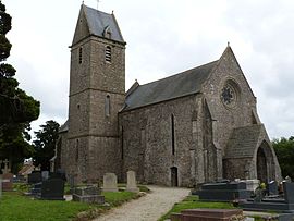 The church of Saint-Pierre | |
show Location of Breuville | |
 Breuville | |
| Coordinates: 49°32′13″N 1°40′17″W / 49.5369°N 1.6714°WCoordinates: 49°32′13″N 1°40′17″W / 49.5369°N 1.6714°W | |
| Country | France |
| Region | Normandy |
| Department | Manche |
| Arrondissement | Cherbourg |
| Canton | Bricquebec-en-Cotentin |
| Intercommunality | CA Cotentin |
| Government | |
| • Mayor (2020–2026) | Jean-Pierre Poignant[1] |
| Area 1 | 8.41 km2 (3.25 sq mi) |
| Population (Jan. 2018)[2] | 415 |
| • Density | 49/km2 (130/sq mi) |
| Time zone | UTC+01:00 (CET) |
| • Summer (DST) | UTC+02:00 (CEST) |
| INSEE/Postal code | 50079 /50260 |
| Elevation | 58–138 m (190–453 ft) (avg. 132 m or 433 ft) |
| 1 French Land Register data, which excludes lakes, ponds, glaciers > 1 km2 (0.386 sq mi or 247 acres) and river estuaries. | |


Breuville is a commune in the Manche department in Normandy in northwestern France.
Population[]
The inhabitants are called Breuvillais.
|
|
See also[]
- Communes of the Manche department
References[]
- ^ "Répertoire national des élus: les maires". data.gouv.fr, Plateforme ouverte des données publiques françaises (in French). 2 December 2020.
- ^ "Populations légales 2018". INSEE. 28 December 2020.
| Wikimedia Commons has media related to Breuville. |
| show Communes of Manche |
|---|
| show Authority control |
|---|
This Manche geographical article is a stub. You can help Wikipedia by . |
Categories:
- Communes of Manche
- Manche geography stubs