Isigny-le-Buat
show This article may be expanded with text translated from the corresponding article in French. (January 2018) Click [show] for important translation instructions. |
Isigny-le-Buat | |
|---|---|
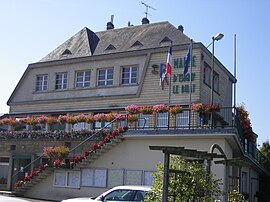 Town hall | |
show Location of Isigny-le-Buat | |
 Isigny-le-Buat | |
| Coordinates: 48°37′N 1°10′W / 48.61°N 1.17°WCoordinates: 48°37′N 1°10′W / 48.61°N 1.17°W | |
| Country | France |
| Region | Normandy |
| Department | Manche |
| Arrondissement | Avranches |
| Canton | Isigny-le-Buat |
| Government | |
| • Mayor (2020–2026) | Jessie Orvain |
| Area 1 | 73.31 km2 (28.31 sq mi) |
| Population (Jan. 2018)[1] | 3,272 |
| • Density | 45/km2 (120/sq mi) |
| Time zone | UTC+01:00 (CET) |
| • Summer (DST) | UTC+02:00 (CEST) |
| INSEE/Postal code | 50256 /50540 |
| Elevation | 23–215 m (75–705 ft) (avg. 100 m or 330 ft) |
| 1 French Land Register data, which excludes lakes, ponds, glaciers > 1 km2 (0.386 sq mi or 247 acres) and river estuaries. | |


Isigny-le-Buat (French pronunciation: [iziɲi lə bɥa]) is a commune in the Manche department in north-western France.
See also[]
- Communes of the Manche department
References[]
- ^ "Populations légales 2018". INSEE. 28 December 2020.
| Wikimedia Commons has media related to Isigny-le-Buat. |
| show Communes of Manche |
|---|
| show Authority control |
|---|
This Manche geographical article is a stub. You can help Wikipedia by . |
Categories:
- Communes of Manche
- Manche geography stubs