Saint-Floxel
Saint-Floxel | |
|---|---|
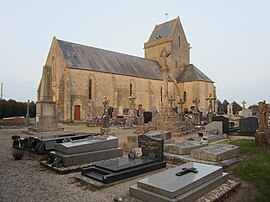 The church of Saint Floxel | |
show Location of Saint-Floxel | |
 Saint-Floxel | |
| Coordinates: 49°29′34″N 1°20′59″W / 49.4928°N 1.3497°WCoordinates: 49°29′34″N 1°20′59″W / 49.4928°N 1.3497°W | |
| Country | France |
| Region | Normandy |
| Department | Manche |
| Arrondissement | Cherbourg |
| Canton | Valognes |
| Intercommunality | CA Cotentin |
| Government | |
| • Mayor (2020–2026) | Joël Guilbert[1] |
| Area 1 | 8.45 km2 (3.26 sq mi) |
| Population (Jan. 2018)[2] | 493 |
| • Density | 58/km2 (150/sq mi) |
| Time zone | UTC+01:00 (CET) |
| • Summer (DST) | UTC+02:00 (CEST) |
| INSEE/Postal code | 50467 /50310 |
| 1 French Land Register data, which excludes lakes, ponds, glaciers > 1 km2 (0.386 sq mi or 247 acres) and river estuaries. | |


Saint-Floxel (French pronunciation: [sɛ̃ flɔksɛl]) is a commune in the Manche department in Normandy in north-western France.
References[]
- ^ "Répertoire national des élus: les maires". data.gouv.fr, Plateforme ouverte des données publiques françaises (in French). 2 December 2020.
- ^ "Populations légales 2018". INSEE. 28 December 2020.
| Wikimedia Commons has media related to Saint-Floxel. |
| show Communes of Manche |
|---|
This Manche geographical article is a stub. You can help Wikipedia by . |
Categories:
- Communes of Manche
- Manche geography stubs