Saint-Maur-des-Bois
Saint-Maur-des-Bois | |
|---|---|
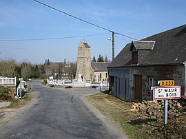 The village and its church | |
show Location of Saint-Maur-des-Bois | |
 Saint-Maur-des-Bois | |
| Coordinates: 48°49′23″N 1°09′22″W / 48.8231°N 1.1561°WCoordinates: 48°49′23″N 1°09′22″W / 48.8231°N 1.1561°W | |
| Country | France |
| Region | Normandy |
| Department | Manche |
| Arrondissement | Avranches |
| Canton | Villedieu-les-Poêles-Rouffigny |
| Government | |
| • Mayor (2020–2026) | Sylvie Marie[1] |
| Area 1 | 4.97 km2 (1.92 sq mi) |
| Population (Jan. 2018)[2] | 153 |
| • Density | 31/km2 (80/sq mi) |
| Time zone | UTC+01:00 (CET) |
| • Summer (DST) | UTC+02:00 (CEST) |
| INSEE/Postal code | 50521 /50800 |
| Elevation | 129–239 m (423–784 ft) (avg. 170 m or 560 ft) |
| 1 French Land Register data, which excludes lakes, ponds, glaciers > 1 km2 (0.386 sq mi or 247 acres) and river estuaries. | |


Saint-Maur-des-Bois is a commune in the Manche department in Normandy in north-western France, close to the border with the Calvados department.
It takes its name from Saint Maurus to whom the parish church is dedicated.
See also[]
- Communes of the Manche department
References[]
- ^ "Répertoire national des élus: les maires". data.gouv.fr, Plateforme ouverte des données publiques françaises (in French). 2 December 2020.
- ^ "Populations légales 2018". INSEE. 28 December 2020.
| Wikimedia Commons has media related to Saint-Maur-des-Bois. |
| show Communes of Manche |
|---|
This Manche geographical article is a stub. You can help Wikipedia by . |
Categories:
- Communes of Manche
- Manche geography stubs