Saint-Patrice-de-Claids
Saint-Patrice-de-Claids | |
|---|---|
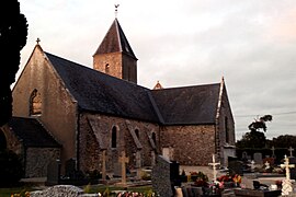 The church in Saint-Patrice-de-Claids | |
show Location of Saint-Patrice-de-Claids | |
 Saint-Patrice-de-Claids | |
| Coordinates: 49°13′51″N 1°26′09″W / 49.2308°N 1.4358°WCoordinates: 49°13′51″N 1°26′09″W / 49.2308°N 1.4358°W | |
| Country | France |
| Region | Normandy |
| Department | Manche |
| Arrondissement | Coutances |
| Canton | Créances |
| Government | |
| • Mayor (2020–2026) | Jean-Luc Launey[1] |
| Area 1 | 5.58 km2 (2.15 sq mi) |
| Population (Jan. 2018)[2] | 179 |
| • Density | 32/km2 (83/sq mi) |
| Time zone | UTC+01:00 (CET) |
| • Summer (DST) | UTC+02:00 (CEST) |
| INSEE/Postal code | 50533 /50190 |
| Elevation | 9–34 m (30–112 ft) (avg. 32 m or 105 ft) |
| 1 French Land Register data, which excludes lakes, ponds, glaciers > 1 km2 (0.386 sq mi or 247 acres) and river estuaries. | |


Church
Saint-Patrice-de-Claids is a commune in the Manche department in Normandy in north-western France.
See also[]
- Communes of the Manche department
References[]
- ^ "Répertoire national des élus: les maires". data.gouv.fr, Plateforme ouverte des données publiques françaises (in French). 2 December 2020.
- ^ "Populations légales 2018". INSEE. 28 December 2020.
| Wikimedia Commons has media related to Saint-Patrice-de-Claids. |
| show Communes of Manche |
|---|
This Manche geographical article is a stub. You can help Wikipedia by . |
Categories:
- Communes of Manche
- Manche geography stubs