104th Street station (IND Fulton Street Line)
104 Street | ||||||||||||||||||||||||||||||||||||||||||||||||||||||||||||||||||||
|---|---|---|---|---|---|---|---|---|---|---|---|---|---|---|---|---|---|---|---|---|---|---|---|---|---|---|---|---|---|---|---|---|---|---|---|---|---|---|---|---|---|---|---|---|---|---|---|---|---|---|---|---|---|---|---|---|---|---|---|---|---|---|---|---|---|---|---|---|
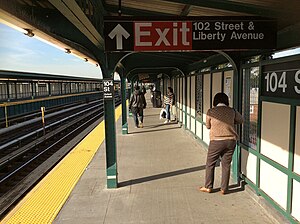 Brooklyn-bound platform | ||||||||||||||||||||||||||||||||||||||||||||||||||||||||||||||||||||
| Station statistics | ||||||||||||||||||||||||||||||||||||||||||||||||||||||||||||||||||||
| Address | 104th Street & Liberty Avenue Queens, NY 11417 | |||||||||||||||||||||||||||||||||||||||||||||||||||||||||||||||||||
| Borough | Queens | |||||||||||||||||||||||||||||||||||||||||||||||||||||||||||||||||||
| Locale | Ozone Park | |||||||||||||||||||||||||||||||||||||||||||||||||||||||||||||||||||
| Coordinates | 40°40′56″N 73°50′14″W / 40.682233°N 73.837352°WCoordinates: 40°40′56″N 73°50′14″W / 40.682233°N 73.837352°W | |||||||||||||||||||||||||||||||||||||||||||||||||||||||||||||||||||
| Division | B (IND, formerly BMT)[1] | |||||||||||||||||||||||||||||||||||||||||||||||||||||||||||||||||||
| Line | IND Fulton Street Line BMT Fulton Street Line (formerly) | |||||||||||||||||||||||||||||||||||||||||||||||||||||||||||||||||||
| Services | A | |||||||||||||||||||||||||||||||||||||||||||||||||||||||||||||||||||
| Transit | ||||||||||||||||||||||||||||||||||||||||||||||||||||||||||||||||||||
| Structure | Elevated | |||||||||||||||||||||||||||||||||||||||||||||||||||||||||||||||||||
| Platforms | 2 side platforms | |||||||||||||||||||||||||||||||||||||||||||||||||||||||||||||||||||
| Tracks | 3 (2 in regular service) | |||||||||||||||||||||||||||||||||||||||||||||||||||||||||||||||||||
| Other information | ||||||||||||||||||||||||||||||||||||||||||||||||||||||||||||||||||||
| Opened | September 25, 1915[2] | |||||||||||||||||||||||||||||||||||||||||||||||||||||||||||||||||||
| Station code | 193[3] | |||||||||||||||||||||||||||||||||||||||||||||||||||||||||||||||||||
| Opposite- direction transfer | Yes | |||||||||||||||||||||||||||||||||||||||||||||||||||||||||||||||||||
| Former/other names | Oxford Avenue 104th Street–Oxford Avenue | |||||||||||||||||||||||||||||||||||||||||||||||||||||||||||||||||||
| Traffic | ||||||||||||||||||||||||||||||||||||||||||||||||||||||||||||||||||||
| 2019 | 536,924[5] | |||||||||||||||||||||||||||||||||||||||||||||||||||||||||||||||||||
| Rank | 406 out of 424[5] | |||||||||||||||||||||||||||||||||||||||||||||||||||||||||||||||||||
| Station succession | ||||||||||||||||||||||||||||||||||||||||||||||||||||||||||||||||||||
| Next west | Rockaway Boulevard: A | |||||||||||||||||||||||||||||||||||||||||||||||||||||||||||||||||||
| Next east | 111th Street: A | |||||||||||||||||||||||||||||||||||||||||||||||||||||||||||||||||||
| ||||||||||||||||||||||||||||||||||||||||||||||||||||||||||||||||||||
| ||||||||||||||||||||||||||||||||||||||||||||||||||||||||||||||||||||
| ||||||||||||||||||||||||||||||||||||||||||||||||||||||||||||||||||||
| ||||||||||||||||||||||||||||||||||||||||||||||||||||||||||||||||||||


The 104th Street station (signed as 104th Street–Oxford Avenue station) is a station on the IND Fulton Street Line of the New York City Subway, located on Liberty Avenue at 104th Street in Ozone Park, Queens. The station is served by the Lefferts Boulevard branch of the A train at all times.
History[]

104th Street was one of the six stations along Liberty Avenue in Queens, from 80th Street through Ozone Park–Lefferts Boulevard, as well as the current three track elevated structure, built for the BMT Fulton Street Line in 1915 as part of BMT's portion of the Dual Contracts.[2][6] The connection to the BMT was severed on April 26, 1956, and the IND was extended east (railroad south) from Euclid Avenue via a connecting tunnel and new intermediate station at Grant Avenue, with the new service beginning on April 29, 1956.[6][7][8] The Fulton Street Elevated west of Hudson Street was closed, and eventually demolished.
The station has gone by a number of different names. It opened as Oxford Avenue.[2] A 1924 system map portrayed the station as "Oxford Avenue", with "104th St." shown below the name in parentheses, and in a smaller print.[9] By 1948, "Oxford" and "104" were shown in equal sizes,[10] and by 1959 the name was shown as "104 St–Oxford".[11] The current official map shows the name as just "104 St".[12] Station signage still shows "104th Street – Oxford Avenue".[13]
The station was completely renovated in 2014.[14][15]
Station layout[]
| P Platform level |
Side platform | |
| Westbound | ← ← | |
| Peak-direction express | No regular service | |
| Eastbound | | |
| Side platform | ||
| M | Mezzanine | Fare control, station agent |
| G | Street level | Exit/entrance |
The station has three tracks and two side platforms. The middle track is not currently used in revenue service.[16] Northwest of the station, there is a view of the abandoned LIRR's Rockaway Beach Branch tracks from the IND Rockaway Line.[13]
After the station was renovated in 2014 and the beginning of 2015, artwork commissioned by MTA Arts & Design and designed by Béatrice Coron was installed, titled On the Right Track.[15][17]
Exits[]
The exit at the northeastern end of the station (railroad south) leads to either eastern corner of Liberty Avenue and 104th Street. At the opposite end of the station there is an exit to either western corner of Liberty Avenue and 102nd Street.[16][18] These exits were closed due to security concerns but were reopened following the station's renovation from 2014 to 2015.
References[]
- ^ "Glossary". Second Avenue Subway Supplemental Draft Environmental Impact Statement (SDEIS) (PDF). Vol. 1. Metropolitan Transportation Authority. March 4, 2003. pp. 1–2. Archived from the original (PDF) on February 26, 2021. Retrieved January 1, 2021.
- ^ a b c "New Elevated Line Opened for Queens" (PDF). The New York Times. September 26, 1915. Retrieved September 28, 2007.
- ^ "Station Developers' Information". Metropolitan Transportation Authority. Retrieved June 13, 2017.
- ^ "Facts and Figures: Annual Subway Ridership 2014–2019". Metropolitan Transportation Authority. 2020. Retrieved May 26, 2020.
- ^ a b "Facts and Figures: Annual Subway Ridership 2014–2019". Metropolitan Transportation Authority. 2020. Retrieved May 26, 2020.
- ^ a b Sparberg, Andrew J. (October 1, 2014). From a Nickel to a Token: The Journey from Board of Transportation to MTA. Fordham University Press. ISBN 978-0-8232-6190-1.
- ^ "First Leg of Rockaways Transit Opened at Cost of $10,154,702" (PDF). New York Times. April 30, 1956. Retrieved June 29, 2015.
- ^ Freeman, Ira Henry (June 28, 1956). "Rockaway Trains to Operate Today" (PDF). New York Times. Retrieved June 29, 2015.
- ^ "BMT Lines, Rapid Transit Division" (GIF). www.nycsubway.com. 1924. Archived from the original on October 12, 2007. Retrieved November 9, 2007.
- ^ "Rapid Transit Lines of the New York City Transit System" (GIF). www.nycsubway.com. 1948. Archived from the original on October 12, 2007. Retrieved November 9, 2007.
- ^ "Official New York City Subway Map and Station Guide" (GIF). www.nycsubway.com. 1959. Archived from the original on October 12, 2007. Retrieved November 9, 2007.
- ^ "Subway Map" (PDF). Metropolitan Transportation Authority. September 2021. Retrieved September 17, 2021.
- ^ a b Cox, Jeremiah. "104 Street-Oxford Avenue (A except Late Night, S-Late Night Shuttle to Lefferts Blvd) - The SubwayNut". www.subwaynut.com. Archived from the original on February 25, 2016. Retrieved February 18, 2016.
- ^ "Queens-bound 88 St and 104 St A Line Stations To Close for Three Months for Renewal". www.mta.info. Metropolitan Transit Authority. May 8, 2014. Archived from the original on May 13, 2014. Retrieved February 18, 2016.
- ^ a b "Final Phase of 104 St and 88 St A Line Station Renewals Completed". www.mta.info. January 30, 2015. Archived from the original on February 3, 2015. Retrieved February 18, 2016.
- ^ a b "www.nycsubway.org: IND Fulton Street Line". www.nycsubway.org. Retrieved February 18, 2016.
- ^ "www.nycsubway.org: Artwork: On the Right Track (Béatrice Coron)". www.nycsubway.org. Retrieved February 18, 2016.
- ^ "MTA Neighborhood Maps: Ozone Park" (PDF). Metropolitan Transportation Authority. 2015. Retrieved October 16, 2015.
External links[]
| Wikimedia Commons has media related to 104th Street (IND Fulton Street Line). |
| Fulton St. Line |
|
|---|---|
| |
- IND Fulton Street Line stations
- BMT Fulton Street Line stations
- New York City Subway stations in Queens, New York
- New York City Subway stations located aboveground
- Railway stations in the United States opened in 1915
- Richmond Hill, Queens
- 1915 establishments in New York City
- Ozone Park, Queens