Ozone Park–Lefferts Boulevard station
Ozone Park–Lefferts Blvd | ||||||||||||||||||||||||||||||||||||||||||||||||||||||||||||||||||||||||||||||||||
|---|---|---|---|---|---|---|---|---|---|---|---|---|---|---|---|---|---|---|---|---|---|---|---|---|---|---|---|---|---|---|---|---|---|---|---|---|---|---|---|---|---|---|---|---|---|---|---|---|---|---|---|---|---|---|---|---|---|---|---|---|---|---|---|---|---|---|---|---|---|---|---|---|---|---|---|---|---|---|---|---|---|---|
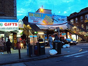 Station house at night, viewed from Lefferts Boulevard and Liberty Avenue | ||||||||||||||||||||||||||||||||||||||||||||||||||||||||||||||||||||||||||||||||||
| Station statistics | ||||||||||||||||||||||||||||||||||||||||||||||||||||||||||||||||||||||||||||||||||
| Address | Lefferts Boulevard & Liberty Avenue Queens, NY 11419 | |||||||||||||||||||||||||||||||||||||||||||||||||||||||||||||||||||||||||||||||||
| Borough | Queens | |||||||||||||||||||||||||||||||||||||||||||||||||||||||||||||||||||||||||||||||||
| Locale | South Richmond Hill | |||||||||||||||||||||||||||||||||||||||||||||||||||||||||||||||||||||||||||||||||
| Coordinates | 40°41′10″N 73°49′27″W / 40.686203°N 73.82422°WCoordinates: 40°41′10″N 73°49′27″W / 40.686203°N 73.82422°W | |||||||||||||||||||||||||||||||||||||||||||||||||||||||||||||||||||||||||||||||||
| Division | B (IND, formerly BMT)[1] | |||||||||||||||||||||||||||||||||||||||||||||||||||||||||||||||||||||||||||||||||
| Line | IND Fulton Street Line BMT Fulton Street Line (formerly) | |||||||||||||||||||||||||||||||||||||||||||||||||||||||||||||||||||||||||||||||||
| Services | A | |||||||||||||||||||||||||||||||||||||||||||||||||||||||||||||||||||||||||||||||||
| Transit | ||||||||||||||||||||||||||||||||||||||||||||||||||||||||||||||||||||||||||||||||||
| Structure | Elevated | |||||||||||||||||||||||||||||||||||||||||||||||||||||||||||||||||||||||||||||||||
| Platforms | 1 island platform | |||||||||||||||||||||||||||||||||||||||||||||||||||||||||||||||||||||||||||||||||
| Tracks | 2 | |||||||||||||||||||||||||||||||||||||||||||||||||||||||||||||||||||||||||||||||||
| Other information | ||||||||||||||||||||||||||||||||||||||||||||||||||||||||||||||||||||||||||||||||||
| Opened | September 25, 1915[2] | |||||||||||||||||||||||||||||||||||||||||||||||||||||||||||||||||||||||||||||||||
| Station code | 195[3] | |||||||||||||||||||||||||||||||||||||||||||||||||||||||||||||||||||||||||||||||||
| Accessible | ||||||||||||||||||||||||||||||||||||||||||||||||||||||||||||||||||||||||||||||||||
| Opposite- direction transfer | N/A | |||||||||||||||||||||||||||||||||||||||||||||||||||||||||||||||||||||||||||||||||
| Former/other names | Lefferts Avenue Lefferts Avenue–119th Street | |||||||||||||||||||||||||||||||||||||||||||||||||||||||||||||||||||||||||||||||||
| Traffic | ||||||||||||||||||||||||||||||||||||||||||||||||||||||||||||||||||||||||||||||||||
| 2019 | 2,216,647[5] | |||||||||||||||||||||||||||||||||||||||||||||||||||||||||||||||||||||||||||||||||
| Rank | 212 out of 424[5] | |||||||||||||||||||||||||||||||||||||||||||||||||||||||||||||||||||||||||||||||||
| Station succession | ||||||||||||||||||||||||||||||||||||||||||||||||||||||||||||||||||||||||||||||||||
| Next west | Rockaway Boulevard (express): no regular service 111th Street (local): A | |||||||||||||||||||||||||||||||||||||||||||||||||||||||||||||||||||||||||||||||||
| Next east | (Terminal): A | |||||||||||||||||||||||||||||||||||||||||||||||||||||||||||||||||||||||||||||||||
| ||||||||||||||||||||||||||||||||||||||||||||||||||||||||||||||||||||||||||||||||||
| ||||||||||||||||||||||||||||||||||||||||||||||||||||||||||||||||||||||||||||||||||
| ||||||||||||||||||||||||||||||||||||||||||||||||||||||||||||||||||||||||||||||||||
| ||||||||||||||||||||||||||||||||||||||||||||||||||||||||||||||||||||||||||||||||||


The Ozone Park–Lefferts Boulevard station is an elevated terminal station on the IND Fulton Street Line of the New York City Subway, located at the intersection of Lefferts Boulevard and Liberty Avenue in Queens. It serves as the terminus of the A route's Lefferts Boulevard branch. Despite its name, the station is not actually located in Ozone Park, but rather in the adjacent neighborhood of South Richmond Hill.
History[]
Lefferts Boulevard was one of the six stations along Liberty Avenue in Queens, from 80th Street through Lefferts Boulevard, as well as the current three track elevated structure, built for the BMT Fulton Street Line in 1915 as part of BMT's portion of the Dual Contracts.[2][6] The connection to the BMT was severed on April 26, 1956, and the IND was extended east (railroad south) from Euclid Avenue via a connecting tunnel and new intermediate station at Grant Avenue, with the new service beginning on April 29, 1956.[6][7][8]
The station has gone by a number of different names. It opened as Lefferts Avenue.[2] A 1924 system map portrayed the station as "Lefferts Avenue", with "119th St." shown below the name in parentheses, and in a smaller print.[9] By 1948, "Lefferts" and "119" were shown in equal sizes,[10] and by 1959 the name was shown as "119 St–Lefferts".[11] Lefferts Avenue was later renamed Lefferts Boulevard, and the station appears as "Ozone Park–Lefferts Boulevard" on the current official map.[12]
In 2014, the Metropolitan Transportation Authority started a renovation project at the Lefferts Boulevard station. The renovation including repairing stairs, doors, floors, windows, canopies and painting the station, and added 2 ADA-accessible elevators (1 outside fare control from street level to mezzanine, and 1 more inside fare control from mezzanine to platform level) at the intersection of Liberty Avenue and Lefferts Boulevard.[13] This project was initially scheduled to be completed in April 2016, but delays occurred due to unforeseen field conditions requiring additional work, and the completion date was pushed back multiple times.[14][15][16][17][18] The elevators ultimately opened in January 2018. The project cost $29 million;[15] $8 million for the station renovation and $21 million for the elevators.[14]
Station layout[]
| P Platform level |
Westbound | ← ← (No express service: Rockaway Boulevard) |
| Island platform | ||
| Westbound | ← ← (No express service: Rockaway Boulevard) | |
| M | Mezzanine | Fare control, station agent, MetroCard machines |
| G | Street level | Exit/entrance |

This station is one of the three southern terminals for the A train. Although this is a "south" terminal in railroad directions (considering the Eighth Avenue Line in Manhattan as north–south), Liberty Avenue underneath runs geographically west-southwest to east-northeast, so a train approach the "south" is actually traveling east-northeast, or more north than south.
This station has one island platform and two tracks. The tracks at the geographic north end of the station end at bumper blocks. At the geographic south end of the station, the line splits from two tracks to three. The middle express track is not currently used in revenue service.
Exits[]
The full-time entrance is at the geographic east end of the station. Three doors lead to a staircase, which descends to an enclosed station house. Past the bumper blocks, an elevator also provides access to that station house. Outside fare control, staircases descend to either western corner of Liberty Avenue and Lefferts Boulevard, while another elevator descends to the northwestern corner of the intersection.[19]
The exits at the opposite end has HEET access, with a mezzanine that leads to either western corner of Liberty Avenue and 116th Street, with various offices and transit employee facilities.[19] This mezzanine was renovated by an in-house contract in 1999. The tile colors here are light beige with dark green accents, installed in 1997.
References[]
- ^ "Glossary". Second Avenue Subway Supplemental Draft Environmental Impact Statement (SDEIS) (PDF). Vol. 1. Metropolitan Transportation Authority. March 4, 2003. pp. 1–2. Archived from the original (PDF) on February 26, 2021. Retrieved January 1, 2021.
- ^ a b c "New Elevated Line Opened for Queens" (PDF). The New York Times. September 26, 1915. Retrieved September 28, 2007.
- ^ "Station Developers' Information". Metropolitan Transportation Authority. Retrieved June 13, 2017.
- ^ "Facts and Figures: Annual Subway Ridership 2014–2019". Metropolitan Transportation Authority. 2020. Retrieved May 26, 2020.
- ^ a b "Facts and Figures: Annual Subway Ridership 2014–2019". Metropolitan Transportation Authority. 2020. Retrieved May 26, 2020.
- ^ a b Sparberg, Andrew J. (October 1, 2014). From a Nickel to a Token: The Journey from Board of Transportation to MTA. Fordham University Press. ISBN 978-0-8232-6190-1.
- ^ "First Leg of Rockaways Transit Opened at Cost of $10,154,702" (PDF). The New York Times. April 30, 1956. Retrieved June 29, 2015.
- ^ Freeman, Ira Henry (June 28, 1956). "Rockaway Trains to Operate Today" (PDF). The New York Times. Retrieved June 29, 2015.
- ^ "BMT Lines, Rapid Transit Division" (GIF). 1924. Retrieved November 9, 2007.
- ^ "Rapid Transit Lines of the New York City Transit System" (GIF). 1948. Retrieved November 9, 2007.
- ^ "Official New York City Subway Map and Station Guide" (GIF). 1959. Retrieved November 9, 2007.
- ^ "Subway Map" (PDF). Metropolitan Transportation Authority. September 2021. Retrieved September 17, 2021.
- ^ "MTA plans upgrade to Lefferts Boulevard A train station". QNS. Retrieved October 23, 2015.
- ^ a b "Capital Program Oversight Committee Meeting" (PDF). mta.info. Metropolitan Transportation Authority. September 25, 2017. p. 107. Retrieved February 24, 2018.
- ^ a b O' Reilly, Anthony (January 25, 2018). "Elevator finally in service at Lefferts". Queens Chronicle. Retrieved February 24, 2018.
- ^ "Utica Av AC Station Becomes the 82nd Fully ADA Accessible Subway Station". MTA. May 23, 2014.
- ^ "Elevator, subway upgrades slated for Lefferts Blvd stop". TimesLedger. Retrieved October 23, 2015.
- ^ "Capital Dashboard | Home Page". web.mta.info. Retrieved July 29, 2016.
- ^ a b "MTA Neighborhood Maps: Ozone Park" (PDF). Metropolitan Transportation Authority. 2015. Retrieved October 16, 2015.
External links[]
| Wikimedia Commons has media related to Ozone Park – Lefferts Boulevard (IND Fulton Street Line). |
- nycsubway.org – IND Fulton Street Line: Lefferts Boulevard
- Station Reporter — A Lefferts
- The Subway Nut — Ozone Park–Lefferts Boulevard Pictures
- Lefferts Boulevard entrance from Google Maps Street View
- 116th Street entrance from Google Maps Street View
- Platform from Google Maps Street View
| Fulton St. Line |
|
|---|---|
| |
- Accessible New York City Subway stations
- 1915 establishments in New York City
- 1917 establishments in New York City
- BMT Fulton Street Line stations
- IND Fulton Street Line stations
- New York City Subway stations in Queens, New York
- New York City Subway stations located aboveground
- New York City Subway terminals
- Railway stations in the United States opened in 1915
- Richmond Hill, Queens