125th Street station (IND Eighth Avenue Line)
125 Street | |||
|---|---|---|---|
 Northbound local track | |||
| Station statistics | |||
| Address | West 125th Street & Saint Nicholas Avenue New York, NY 10027 | ||
| Borough | Manhattan | ||
| Locale | Harlem | ||
| Coordinates | 40°48′39″N 73°57′10″W / 40.810756°N 73.952665°WCoordinates: 40°48′39″N 73°57′10″W / 40.810756°N 73.952665°W | ||
| Division | B (IND)[1] | ||
| Line | IND Eighth Avenue Line | ||
| Services | A B C D | ||
| Transit | |||
| Structure | Underground | ||
| Platforms | 2 island platforms cross-platform interchange | ||
| Tracks | 4 | ||
| Other information | |||
| Opened | September 10, 1932[2] | ||
| Station code | 153[3] | ||
| Accessible | |||
| Opposite- direction transfer | Yes | ||
| Traffic | |||
| 2019 | 9,208,598[5] | ||
| Rank | 31 out of 424[5] | ||
| Station succession | |||
| Next north | 145th Street (Eighth express): A 145th Street (Concourse express): D 135th Street (Eighth local): A | ||
| Next south | 116th Street (Eighth local): A 59th Street–Columbus Circle (Eighth express): A | ||
| |||
| |||
| |||
| |||


125th Street is an express station on the IND Eighth Avenue Line of the New York City Subway. Located at the intersection of 125th Street and St. Nicholas Avenue in the Harlem neighborhood of Manhattan, it is served by the A and D trains at all times, by the C train at all times except late nights, and by the B train on weekdays.
Nearby landmarks and points of interest include the Apollo Theater and the Touro College of Osteopathic Medicine.
History[]
The station opened on September 10, 1932, as part of the city-operated Independent Subway System (IND)'s initial segment, the Eighth Avenue Line between Chambers Street and 207th Street.[2][6]
In 1981, the MTA listed the station among the 69 most deteriorated stations in the subway system.[7] The station was renovated in the 1980s, during which two stairs to each platform at the north end were removed and the platforms' original white floor tiling was replaced.[8] The station was damaged in a water main break in 1989.[9] Another renovation later[when?] restored the closed staircases and made the station ADA-accessible with the installation of elevators near the middle of the platforms.[citation needed]
On June 27, 2017, a southbound A train derailed just north of the station. This derailment, caused by improperly secured replacement rails, left 34 passengers injured.[10]
Station layout[]
| G | Street level | Entrance/exit |
| M | Mezzanine | Fare control, station agents |
| P Platform level |
Northbound local | ← ← ← |
| Island platform | ||
| Northbound express | ← ← | |
| Southbound express | | |
| Island platform | ||
| Southbound local | | |
The outer track wall tiles have a Prussian green trim line with a black border with small "125" signs in white lettering on a black background beneath it. Both platforms have one line of green I-beam columns that run at regular intervals for their entire length except for a small section at either ends. Every other column has the standard black station name plate in white lettering.
The station has a mezzanine above the tracks at the Southern end and platforms that connect both fare control areas at either ends. There are five staircases to each platform and large-scale photos of Harlem in the 1920s and 1930s.
The next express station to the south, 59th Street–Columbus Circle, is 3.35 miles (5.391 km) away with seven local stations in between, which is the longest distance between two express stops in the system.
Exits[]
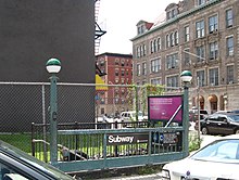
The full-time fare control area is at the south end of the mezzanine, serving the 125th Street exits, and has a turnstile bank and token booth. It serves the exits at St. Nicholas Avenue and West 125th Street. The other fare control area at the north end, serving the 127th Street exits, is unstaffed, containing full height turnstiles. There is also evidence of closed exit stairs going up to 126th Street and 124th Street, one on each side of both mezzanines.[8] One of the staircases led directly into the basement of a business that existed at street level.[8]
- One stair, NW corner of St. Nicholas Avenue and West 125th Street[11]
- One stair, NE corner of St. Nicholas Avenue and West 125th Street[11]
 One stair and one elevator, SW corner of St. Nicholas Avenue and West 125th Street[11]
- One stair, SE corner of St. Nicholas Avenue and West 125th Street[11]
- One stair, SW corner of St. Nicholas Avenue and West 127th Street[11]
- One stair, SE corner of St. Nicholas Avenue and West 127th Street[11]
References[]
- ^ "Glossary". Second Avenue Subway Supplemental Draft Environmental Impact Statement (SDEIS) (PDF). 1. Metropolitan Transportation Authority. March 4, 2003. pp. 1–2. Archived from the original (PDF) on February 26, 2021. Retrieved January 1, 2021.
- ^ Jump up to: a b "List of the 28 Stations on the New 8th Av. Line". The New York Times. September 10, 1932. p. 6. ISSN 0362-4331. Retrieved April 21, 2020.
- ^ "Station Developers' Information". Metropolitan Transportation Authority. Retrieved June 13, 2017.
- ^ "Facts and Figures: Annual Subway Ridership 2014–2019". Metropolitan Transportation Authority. 2020. Retrieved May 26, 2020.
- ^ Jump up to: a b "Facts and Figures: Annual Subway Ridership 2014–2019". Metropolitan Transportation Authority. 2020. Retrieved May 26, 2020.
- ^ Crowell, Paul (September 10, 1932). "Gay Midnight Crowd Rides First Trains In The New Subway: Throngs at Station an Hour Before Time, Rush Turnstiles When Chains are Dropped" (PDF). The New York Times. Retrieved November 8, 2015.
- ^ Gargan, Edward A. (June 11, 1981). "Agency Lists Its 69 Most Deteriorated Subway Stations". The New York Times. p. B5S. ISSN 0362-4331. Archived from the original on March 31, 2019. Retrieved August 13, 2016.
- ^ Jump up to: a b c Review of the A and C Lines (PDF) (Report). Metropolitan Transportation Authority. December 11, 2015. Archived from the original (PDF) on February 3, 2020. Retrieved January 19, 2016.
- ^ "Metro Datelines; Repairs to the IND May Cost $20 Million". The New York Times. December 8, 1989. ISSN 0362-4331. Retrieved April 16, 2020.
- ^ Santora, Marc; Fitzsimmons, Emma G. (June 27, 2017). "Subway Derailment in Manhattan Injures Dozens". The New York Times. p. 1. ISSN 0362-4331. Archived from the original on June 27, 2017. Retrieved April 16, 2020.
- ^ Jump up to: a b c d e f "MTA Neighborhood Maps: Morningside Heights" (PDF). mta.info. Metropolitan Transportation Authority. 2018. Retrieved October 1, 2018.
External links[]
| Wikimedia Commons has media related to 125th Street (IND Eighth Avenue Line). |
- nycsubway.org – IND 8th Avenue: 125th Street
- Station Reporter — A Lefferts
- Station Reporter — A Rockaway
- Station Reporter — B Train
- Station Reporter — C Train
- Station Reporter — D Train
- The Subway Nut — 125th Street Pictures Archived May 29, 2017, at the Wayback Machine
- 125th Street entrance at southwest corner from Google Maps Street View
- 127th Street entrance at southwest corner from Google Maps Street View
- Platforms from Google Maps Street View
- Accessible New York City Subway stations
- IND Eighth Avenue Line stations
- New York City Subway stations in Manhattan
- New York City Subway stations located underground
- Railway stations in the United States opened in 1932
- Harlem
- 1932 establishments in New York (state)