High Street station (IND Eighth Avenue Line)
High Street | ||||||||||||||||||||||||||||||||||||||||||||||||||||||||||||||||||||||||||||||||||
|---|---|---|---|---|---|---|---|---|---|---|---|---|---|---|---|---|---|---|---|---|---|---|---|---|---|---|---|---|---|---|---|---|---|---|---|---|---|---|---|---|---|---|---|---|---|---|---|---|---|---|---|---|---|---|---|---|---|---|---|---|---|---|---|---|---|---|---|---|---|---|---|---|---|---|---|---|---|---|---|---|---|---|
 Station curvature | ||||||||||||||||||||||||||||||||||||||||||||||||||||||||||||||||||||||||||||||||||
| Station statistics | ||||||||||||||||||||||||||||||||||||||||||||||||||||||||||||||||||||||||||||||||||
| Address | High Street & Cadman Plaza East Brooklyn, NY 11201 | |||||||||||||||||||||||||||||||||||||||||||||||||||||||||||||||||||||||||||||||||
| Borough | Brooklyn | |||||||||||||||||||||||||||||||||||||||||||||||||||||||||||||||||||||||||||||||||
| Locale | Brooklyn Heights, DUMBO, Downtown Brooklyn | |||||||||||||||||||||||||||||||||||||||||||||||||||||||||||||||||||||||||||||||||
| Coordinates | 40°41′56″N 73°59′23″W / 40.69889°N 73.98972°WCoordinates: 40°41′56″N 73°59′23″W / 40.69889°N 73.98972°W | |||||||||||||||||||||||||||||||||||||||||||||||||||||||||||||||||||||||||||||||||
| Division | B (IND)[1] | |||||||||||||||||||||||||||||||||||||||||||||||||||||||||||||||||||||||||||||||||
| Line | IND Eighth Avenue Line | |||||||||||||||||||||||||||||||||||||||||||||||||||||||||||||||||||||||||||||||||
| Services | A C | |||||||||||||||||||||||||||||||||||||||||||||||||||||||||||||||||||||||||||||||||
| Transit | ⛴ NYC Ferry: East River and South Brooklyn routes (at Old Fulton Street and Furman Street) | |||||||||||||||||||||||||||||||||||||||||||||||||||||||||||||||||||||||||||||||||
| Structure | Underground | |||||||||||||||||||||||||||||||||||||||||||||||||||||||||||||||||||||||||||||||||
| Platforms | 1 island platform | |||||||||||||||||||||||||||||||||||||||||||||||||||||||||||||||||||||||||||||||||
| Tracks | 2 | |||||||||||||||||||||||||||||||||||||||||||||||||||||||||||||||||||||||||||||||||
| Other information | ||||||||||||||||||||||||||||||||||||||||||||||||||||||||||||||||||||||||||||||||||
| Opened | June 24, 1933[2] | |||||||||||||||||||||||||||||||||||||||||||||||||||||||||||||||||||||||||||||||||
| Station code | 173[3] | |||||||||||||||||||||||||||||||||||||||||||||||||||||||||||||||||||||||||||||||||
| Opposite- direction transfer | Yes | |||||||||||||||||||||||||||||||||||||||||||||||||||||||||||||||||||||||||||||||||
| Former/other names | High Street–Brooklyn Bridge, Brooklyn Bridge Plaza, Cranberry Street | |||||||||||||||||||||||||||||||||||||||||||||||||||||||||||||||||||||||||||||||||
| Traffic | ||||||||||||||||||||||||||||||||||||||||||||||||||||||||||||||||||||||||||||||||||
| 2019 | 3,536,860[4] | |||||||||||||||||||||||||||||||||||||||||||||||||||||||||||||||||||||||||||||||||
| Rank | 142 out of 424[4] | |||||||||||||||||||||||||||||||||||||||||||||||||||||||||||||||||||||||||||||||||
| Station succession | ||||||||||||||||||||||||||||||||||||||||||||||||||||||||||||||||||||||||||||||||||
| Next north | Fulton Street: A | |||||||||||||||||||||||||||||||||||||||||||||||||||||||||||||||||||||||||||||||||
| Next south | Jay Street–MetroTech: A | |||||||||||||||||||||||||||||||||||||||||||||||||||||||||||||||||||||||||||||||||
| ||||||||||||||||||||||||||||||||||||||||||||||||||||||||||||||||||||||||||||||||||
| ||||||||||||||||||||||||||||||||||||||||||||||||||||||||||||||||||||||||||||||||||
| ||||||||||||||||||||||||||||||||||||||||||||||||||||||||||||||||||||||||||||||||||
| ||||||||||||||||||||||||||||||||||||||||||||||||||||||||||||||||||||||||||||||||||


High Street, also labeled as High Street–Brooklyn Bridge, and also referred to as Brooklyn Bridge Plaza and Cranberry Street,[5][6][7] is a station on the IND Eighth Avenue Line of the New York City Subway. It is located at Cadman Plaza East near Red Cross Place and the Brooklyn Bridge approach in Brooklyn Heights, Brooklyn. Its name comes from older street names; its original location was at the intersection of High Street and Washington Street. It is served by the A train at all times and the C train at all times except late nights.
History[]

The High Street station was part of a three-stop extension of the IND Eighth Avenue Line from Chambers Street in Lower Manhattan to Jay Street–Borough Hall in Downtown Brooklyn.[5][6][7] Construction of the extension began in June 1928.[7] Due to the station's proximity to the Cranberry Street Tunnel under the East River, instead of typical cut-and-cover (or open-cut) construction methods, the station site was constructed 70 feet (21 m) below the street (the tunnel is 90 feet (27 m) below the surface at its lowest point) using mining techniques. The station was built between the eastern ends of the cast-iron river tubes reinforced with cement, leading to its tubular design.[7] The depth of the station meant that few buildings in the area would be disturbed or demolished, except for two structures along Cranberry Street between Henry Street and Old Fulton Street.[8]
The extension opened to Jay Street on February 1, 1933, but the High Street station remained closed for an additional five months. The trains ran through the station without stopping, because the escalators to the street had not been completed due to lack of funding.[5][6][9] That month, the contract for four escalators in the station was awarded to Otis Elevator Company.[10] The station opened on June 24, 1933.[2]
The station was located below the sites of the Sands Street terminal for BMT elevated trains, some of which traveled over the Brooklyn Bridge.[11] The BMT station closed in 1944 and was replaced by Cadman Plaza.[12] Old Fulton Street (now Cadman Plaza West) and Cranberry Street was also the site of the printing shop where Walt Whitman's Leaves of Grass was first published in 1855.[13] The area is now the site of the Whitman Close Apartments.[14]
The High Street station was the site of an attempted robbery of subway revenue on June 18, 1954, in which the unarmed perpetrator was fatally shot by one of the two armed transit employees collecting fares and already-used transfer slips from token booths.[15]
In the 1970s, the escalators at the eastern end of the station to Adams Street were replaced.[16]
Station layout[]
| G | Street level | Exit/entrance |
| B1 | Mezzanine | Fare control, station agent, escalators |
| B2 Platform level |
Northbound | ← ← |
| Island platform | ||
| Southbound | | |


This underground station has two tracks and one island platform. It is the northernmost Brooklyn station for the A and C trains. To the north, the IND Eighth Avenue Line enters the Cranberry Street Tunnel and passes under the East River into Manhattan.[17] As a result, the station was built in a tube design, and built with escalators between the upper fare control level and the lower mezzanine level to easier traverse the 70 foot (21 m) drop below street level.[6][7][2][18]
East (railroad south) of the station, the line curves south onto Jay Street and has three track switches with the IND Sixth Avenue Line.[14] A power station for the line is located on the west side of Jay Street just north of Concord Street.[19] A second substation is located at Red Cross Place and Cadman Plaza East.[19]
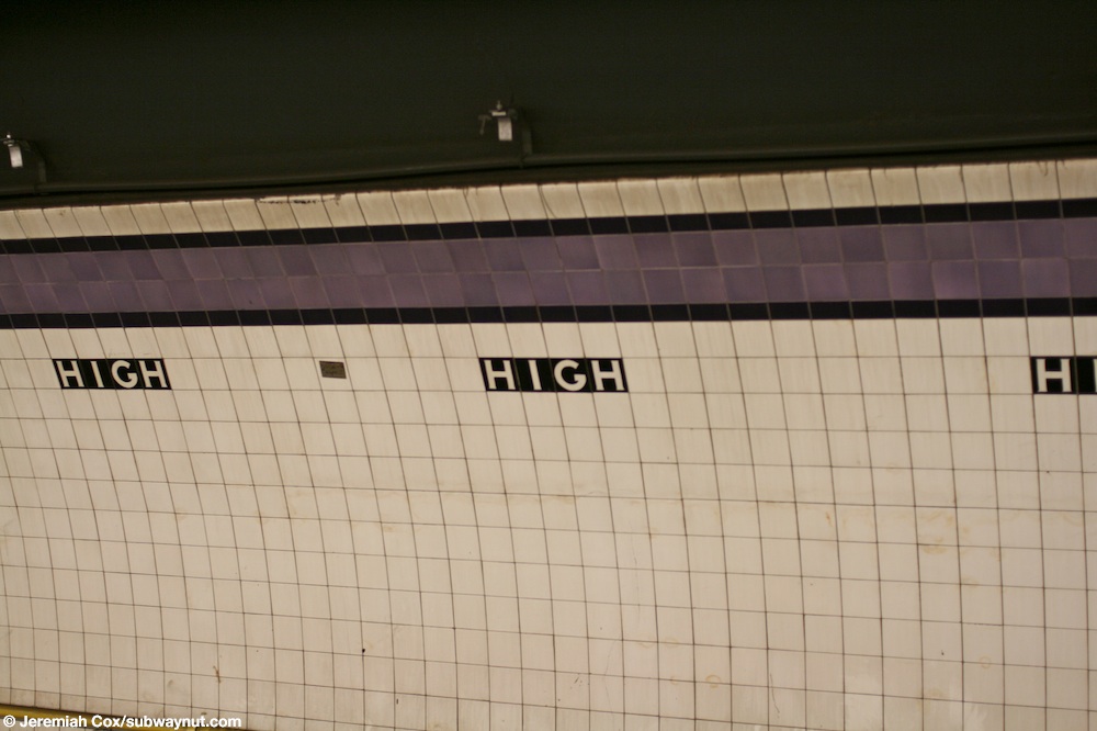
Both trackside walls have a dark lavender trim line with an eggplant border, below which are small tile captions reading "HIGH" in white lettering on a black background. Thick I-beam columns painted dark indigo run along the platform at regular intervals, alternating ones having the standard black station name plate with white lettering.[20]
Exits[]
There are exits at both ends to the full length mezzanine[14] along with evidence of removed center exits; since this station was built, the area now known as Cadman Plaza was completely rebuilt. Cadman Plaza East, the short one-block street outside the Red Cross Place exit, was previously called Washington Street;[19] the Washington Street moniker still applies to the road north of Prospect Street.[21] High Street is not directly accessible from the station, as the short one-block street is interrupted by a parking lot.[14] However, Red Cross Place, which was once a part of High Street,[19] is directly accessible.[14]
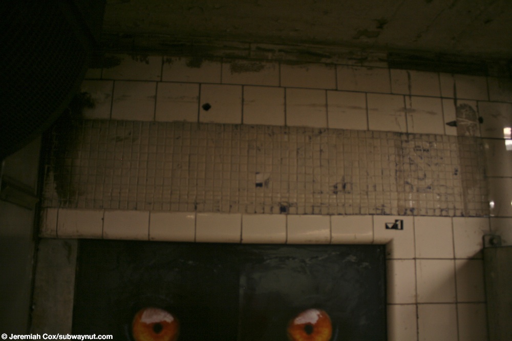
The geographic western exit leads to Cadman Plaza West/Old Fulton Street (formerly Fulton Street, as indicated on wall mosaic signs)[2][19][22] in Brooklyn Heights, a few hundred feet south of Cadman Plaza West's intersection with Middagh Street. This was the original exit to the station.[2][14][22] The eastern exits lead to Adams Street, on the border of Brooklyn Heights, DUMBO and Downtown Brooklyn, adjacent to the central courthouse for the Federal Eastern District of New York. These exits were opened following an additional delay to complete the escalators.[2][14] Adams Street was widened from 100 feet to 160 feet in the 1950s to accommodate new ramps to the Brooklyn Bridge,[19] and now carries the secondary name "Brooklyn Bridge Boulevard". The current exit staircases lead to ether side of Adams Street, acting as a pedestrian underpass.[14] There are painted-over mosaics pointing to former exits at Washington Street (now Cadman Plaza East).[23]
Ridership[]
In 2017, the station had 2,983,672 boardings, making it the 171st most used station in the 425-station system. This amounted to an average of 9,215 passengers per weekday.[4] In 2014, the station had an average of 8,870 daily weekday boardings, up from 5,410 daily boardings in 2005; this represented a 64% ridership increase over nine years.[24] The station is the 26th busiest of all stations served by the A and C trains.[24]
References[]
- ^ "Glossary". Second Avenue Subway Supplemental Draft Environmental Impact Statement (SDEIS) (PDF). 1. Metropolitan Transportation Authority. March 4, 2003. pp. 1–2. Archived from the original (PDF) on February 26, 2021. Retrieved January 1, 2021.
- ^ a b c d e f "Jobs Are All Filled on Subway Links – Board Reports Thousands Already Listed – High St. Station, Brooklyn, Opened" (PDF). The New York Times. June 25, 1933. Retrieved October 27, 2015.
- ^ "Station Developers' Information". Metropolitan Transportation Authority. Retrieved June 13, 2017.
- ^ a b "Facts and Figures: Annual Subway Ridership 2014–2019". Metropolitan Transportation Authority. 2020. Retrieved May 26, 2020.
- ^ a b c "City Opens Subway to Brooklyn Today: Regular Express Service on the Extension of Independent Line Starts at 6:05 A.M." (PDF). The New York Times. February 1, 1933. p. 19. Retrieved October 27, 2015.
- ^ a b c d "City Subway To Open Here About Feb. 1: Trains to Run to Borough Hall-O'Brien to Speed Funds for Completion". Brooklyn Daily Eagle. January 15, 1933. p. 2. Retrieved October 27, 2015 – via Newspapers.com.
- ^ a b c d e Whitman, Hamilton (March 16, 1930). "The Sandhogs: Men of Courage, Energy and Skill". Brooklyn Daily Eagle. p. 89. Retrieved October 27, 2015 – via Newspapers.com.
- ^ "Subway Dirt Will Start to Fly Here Soon: Board Indicates Private Property to Be Taken in Cranberry Street". Brooklyn Standard Union. November 10, 1927. p. 2. Retrieved June 30, 2016 – via Fultonhistory.com.
- ^ "New Subway Link Opens Wednesday: Independent Line Will Offer Express Service to Borough Hall in Brooklyn" (PDF). The New York Times. January 29, 1933. Retrieved November 4, 2015.
- ^ "Otis To Install 16 Escalators For Subways: Work to Start at Once on Contract Given for Independent N.Y. System". The Herald Statesman. Fultonhistory.com. February 20, 1933. Retrieved June 30, 2016.
- ^ "Work Starts On Boro Hall Trolley Loop: Extra Track to Be Built on Joralemon St.-New Downtown Routing Plan". Brooklyn Daily Eagle. February 7, 1930. p. 3. Retrieved October 27, 2015 – via Newspapers.com.
- ^ "Last Train Is Run on Fulton St. 'El' – Mayor, Cashmore, Officials and Civic Leaders Make Trip to Brooklyn Terminus – Razing to Start Soon – 'Funeral' Services for Line, Built in 1888, Are Held in Kings During Afternoon". The New York Times. June 1, 1940. p. 17. Retrieved December 16, 2016.
- ^ "A Gesture in Cranberry Street". Brooklyn Daily Eagle. June 1, 1931. p. 18. Retrieved October 27, 2015 – via Newspapers.com.
- ^ a b c d e f g h "MTA Neighborhood Maps: Downtown Brooklyn & Borough Hall" (PDF). mta.info. Metropolitan Transportation Authority. 2015. Retrieved August 2, 2015.
- ^ "Collector Slays Subway Bandit". Brooklyn Daily Eagle. June 18, 1954. pp. 1, 11. Retrieved October 27, 2015 – via Newspapers.com.
- ^ "Escalators Being Replaced on New York Subways" (PDF). The New York Times. November 25, 1977. Retrieved October 27, 2015.
- ^ "Subway Map" (PDF). Metropolitan Transportation Authority. September 2021. Retrieved September 17, 2021.
- ^ "Taxpayer's Suit on Subway Heard – Decision Reserved on Motion to Block Interest Payment on 8th Av. Line's Bonds – Road's Status is Argued – Plaintiff Contends It Is 'Separate Railroad' — City Holds It One Unit in System". June 17, 1933. p. 15. Retrieved April 20, 2020.
- ^ a b c d e f "New Downtown Artery Is Sought". Brooklyn Daily Eagle. November 4, 1954. pp. 1, 14. Retrieved October 27, 2015 – via Newspapers.com.
- ^ Cox, Jeremiah (May 16, 2008). "Looking at the purple trimline with a black boarder and black High text beneath it along the platform walls at High St". subwaynut.com. Retrieved December 16, 2016.
- ^ Google (July 10, 2016). "Cadman Plaza E" (Map). Google Maps. Google. Retrieved July 10, 2016.
- ^ a b Douglass, Harvey (June 26, 1933). "Brooklyn's 'Main Street' Plays Minor Role". Brooklyn Daily Eagle. p. 15. Retrieved July 4, 2016 – via Newspapers.com.
- ^ Photo of painted-over mosaic sign to Washington Street, subwaynut.com. The Subway Nut. Retrieved April 27, 2016.
- ^ a b Review of the A and C Lines (PDF) (Report). Metropolitan Transportation Authority. December 11, 2015. Archived from the original (PDF) on February 3, 2020. Retrieved January 19, 2016.
External links[]
| Wikimedia Commons has media related to High Street (IND Eighth Avenue Line). |
- nycsubway.org – IND 8th Avenue: High Street/Brooklyn Bridge
- The Subway Nut—High Street – Brooklyn Bridge Pictures
- Adams Street, west of Brooklyn Bridge Approach entrance from Google Maps Street View
- Adams Street, east of Brooklyn Bridge Approach entrance from Google Maps Street View
- Old Fulton Street entrance from Google Maps Street View
- Platform from Google Maps Street View
| Eighth Ave. Line |
|
|---|---|
| |
- 1933 establishments in New York City
- Brooklyn Heights
- IND Eighth Avenue Line stations
- New York City Subway stations in Brooklyn
- New York City Subway stations located underground
- Railway stations in the United States opened in 1933