Birac, Gironde
Birac | |
|---|---|
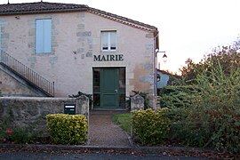 Town hall | |
 Coat of arms | |
show Location of Birac | |
 Birac | |
| Coordinates: 44°25′07″N 0°08′10″W / 44.4186°N 0.1361°WCoordinates: 44°25′07″N 0°08′10″W / 44.4186°N 0.1361°W | |
| Country | France |
| Region | Nouvelle-Aquitaine |
| Department | Gironde |
| Arrondissement | Langon |
| Canton | Le Sud-Gironde |
| Intercommunality | Bazadais |
| Government | |
| • Mayor (2020–2026) | Jean-Pierre Manseau |
| Area 1 | 10.17 km2 (3.93 sq mi) |
| Population (Jan. 2018)[1] | 230 |
| • Density | 23/km2 (59/sq mi) |
| Time zone | UTC+01:00 (CET) |
| • Summer (DST) | UTC+02:00 (CEST) |
| INSEE/Postal code | 33053 /33430 |
| Elevation | 48–135 m (157–443 ft) (avg. 130 m or 430 ft) |
| 1 French Land Register data, which excludes lakes, ponds, glaciers > 1 km2 (0.386 sq mi or 247 acres) and river estuaries. | |


Birac is a commune in the Gironde department in Nouvelle-Aquitaine in southwestern France.
Population[]
| Year | Pop. | ±% |
|---|---|---|
| 1962 | 222 | — |
| 1968 | 233 | +5.0% |
| 1975 | 188 | −19.3% |
| 1982 | 200 | +6.4% |
| 1990 | 180 | −10.0% |
| 1999 | 182 | +1.1% |
| 2008 | 225 | +23.6% |
See also[]
References[]
- ^ "Populations légales 2018". INSEE. 28 December 2020.
| Wikimedia Commons has media related to Birac (Gironde). |
This Gironde geographical article is a stub. You can help Wikipedia by . |
Categories:
- Communes of Gironde
- Gironde geography stubs