Sendets, Gironde
Sendets | |
|---|---|
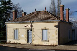 The town hall in Sendets | |
show Location of Sendets | |
 Sendets | |
| Coordinates: 44°25′25″N 0°05′14″W / 44.4236°N 0.0872°WCoordinates: 44°25′25″N 0°05′14″W / 44.4236°N 0.0872°W | |
| Country | France |
| Region | Nouvelle-Aquitaine |
| Department | Gironde |
| Arrondissement | Langon |
| Canton | Le Sud-Gironde |
| Intercommunality | Bazadais |
| Government | |
| • Mayor (2020–2026) | Eric Vigneau |
| Area 1 | 8.36 km2 (3.23 sq mi) |
| Population (Jan. 2018)[1] | 339 |
| • Density | 41/km2 (110/sq mi) |
| Time zone | UTC+01:00 (CET) |
| • Summer (DST) | UTC+02:00 (CEST) |
| INSEE/Postal code | 33511 /33690 |
| Elevation | 78–144 m (256–472 ft) (avg. 142 m or 466 ft) |
| 1 French Land Register data, which excludes lakes, ponds, glaciers > 1 km2 (0.386 sq mi or 247 acres) and river estuaries. | |


Sendets is a commune in the Gironde department in Nouvelle-Aquitaine in southwestern France.
Population[]
| Year | Pop. | ±% |
|---|---|---|
| 1962 | 324 | — |
| 1968 | 328 | +1.2% |
| 1975 | 288 | −12.2% |
| 1982 | 232 | −19.4% |
| 1990 | 234 | +0.9% |
| 1999 | 255 | +9.0% |
| 2008 | 301 | +18.0% |
See also[]
References[]
- ^ "Populations légales 2018". INSEE. 28 December 2020.
| Wikimedia Commons has media related to Sendets (Gironde). |
This Gironde geographical article is a stub. You can help Wikipedia by . |
Categories:
- Communes of Gironde
- Gironde geography stubs