Labarde
Labarde | |
|---|---|
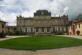 Chateau Giscours | |
 Coat of arms | |
show Location of Labarde | |
 Labarde | |
| Coordinates: 45°00′57″N 0°38′20″W / 45.0158°N 0.6389°WCoordinates: 45°00′57″N 0°38′20″W / 45.0158°N 0.6389°W | |
| Country | France |
| Region | Nouvelle-Aquitaine |
| Department | Gironde |
| Arrondissement | Lesparre-Médoc |
| Canton | Le Sud-Médoc |
| Intercommunality | Médoc Estuaire |
| Government | |
| • Mayor (2008–2014) | Liliane Monnereau |
| Area 1 | 4.76 km2 (1.84 sq mi) |
| Population (Jan. 2018)[1] | 593 |
| • Density | 120/km2 (320/sq mi) |
| Time zone | UTC+01:00 (CET) |
| • Summer (DST) | UTC+02:00 (CEST) |
| INSEE/Postal code | 33211 /33460 |
| Elevation | 2–17 m (6.6–55.8 ft) (avg. 16 m or 52 ft) |
| 1 French Land Register data, which excludes lakes, ponds, glaciers > 1 km2 (0.386 sq mi or 247 acres) and river estuaries. | |


Labarde is a commune in the Gironde department in Nouvelle-Aquitaine in southwestern France.
Population[]
| Year | Pop. | ±% |
|---|---|---|
| 1962 | 427 | — |
| 1968 | 435 | +1.9% |
| 1975 | 445 | +2.3% |
| 1982 | 453 | +1.8% |
| 1990 | 695 | +53.4% |
| 1999 | 635 | −8.6% |
| 2008 | 619 | −2.5% |
See also[]
References[]
- ^ "Populations légales 2018". INSEE. 28 December 2020.
| Wikimedia Commons has media related to Labarde. |
This Gironde geographical article is a stub. You can help Wikipedia by . |
Categories:
- Communes of Gironde
- Gironde geography stubs