Le Pian-Médoc
Le Pian-Médoc | |
|---|---|
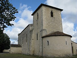 The church in Le Pian-Médoc | |
 Coat of arms | |
show Location of Le Pian-Médoc | |
 Le Pian-Médoc | |
| Coordinates: 44°57′21″N 0°40′07″W / 44.9558°N 0.6686°WCoordinates: 44°57′21″N 0°40′07″W / 44.9558°N 0.6686°W | |
| Country | France |
| Region | Nouvelle-Aquitaine |
| Department | Gironde |
| Arrondissement | Bordeaux |
| Canton | Les Portes du Médoc |
| Intercommunality | Médoc Estuaire |
| Government | |
| • Mayor (2020–2026) | Didier Mau |
| Area 1 | 30.12 km2 (11.63 sq mi) |
| Population (Jan. 2018)[1] | 6,739 |
| • Density | 220/km2 (580/sq mi) |
| Time zone | UTC+01:00 (CET) |
| • Summer (DST) | UTC+02:00 (CEST) |
| INSEE/Postal code | 33322 /33290 |
| Elevation | 5–37 m (16–121 ft) |
| 1 French Land Register data, which excludes lakes, ponds, glaciers > 1 km2 (0.386 sq mi or 247 acres) and river estuaries. | |


Le Pian-Médoc (French pronunciation: [lə pjɑ̃ medɔk]; Occitan: Lo Pian) is a commune in the Gironde department in Nouvelle-Aquitaine in southwestern France.
Population[]
| Year | Pop. | ±% |
|---|---|---|
| 1962 | 967 | — |
| 1968 | 1,144 | +18.3% |
| 1975 | 1,948 | +70.3% |
| 1982 | 3,481 | +78.7% |
| 1990 | 5,078 | +45.9% |
| 1999 | 5,373 | +5.8% |
| 2008 | 5,245 | −2.4% |
See also[]
References[]
- ^ "Populations légales 2018". INSEE. 28 December 2020.
| Wikimedia Commons has media related to Le Pian-Médoc. |
This Gironde geographical article is a stub. You can help Wikipedia by . |
Categories:
- Communes of Gironde
- Gironde geography stubs