Caudrot
Caudrot | |
|---|---|
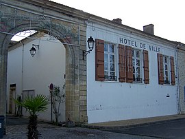 Town hall | |
 Coat of arms | |
show Location of Caudrot | |
 Caudrot | |
| Coordinates: 44°34′39″N 0°08′33″W / 44.5775°N 0.1425°WCoordinates: 44°34′39″N 0°08′33″W / 44.5775°N 0.1425°W | |
| Country | France |
| Region | Nouvelle-Aquitaine |
| Department | Gironde |
| Arrondissement | Langon |
| Canton | L'Entre-Deux-Mers |
| Government | |
| • Mayor (2008–2014) | Roland Laporte |
| Area 1 | 6.12 km2 (2.36 sq mi) |
| Population (Jan. 2018)[1] | 1,148 |
| • Density | 190/km2 (490/sq mi) |
| Time zone | UTC+01:00 (CET) |
| • Summer (DST) | UTC+02:00 (CEST) |
| INSEE/Postal code | 33111 /33490 |
| Elevation | 6–111 m (20–364 ft) (avg. 10 m or 33 ft) |
| 1 French Land Register data, which excludes lakes, ponds, glaciers > 1 km2 (0.386 sq mi or 247 acres) and river estuaries. | |


Caudrot is a commune in the Gironde department in Nouvelle-Aquitaine in southwestern France.
Geography[]
The Dropt flows into the Garonne in Caudrot.
Population[]
| Year | Pop. | ±% |
|---|---|---|
| 1962 | 783 | — |
| 1968 | 814 | +4.0% |
| 1975 | 809 | −0.6% |
| 1982 | 844 | +4.3% |
| 1990 | 945 | +12.0% |
| 1999 | 933 | −1.3% |
| 2008 | 1,067 | +14.4% |
See also[]
References[]
- ^ "Populations légales 2018". INSEE. 28 December 2020.
| Wikimedia Commons has media related to Caudrot. |
This Gironde geographical article is a stub. You can help Wikipedia by . |
Categories:
- Communes of Gironde
- Gironde geography stubs