Préchac, Gironde
Préchac | |
|---|---|
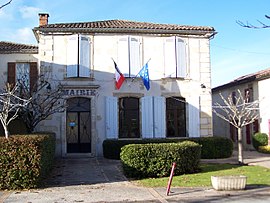 Town hall | |
 Coat of arms | |
show Location of Préchac | |
 Préchac | |
| Coordinates: 44°24′02″N 0°21′07″W / 44.4006°N 0.3519°WCoordinates: 44°24′02″N 0°21′07″W / 44.4006°N 0.3519°W | |
| Country | France |
| Region | Nouvelle-Aquitaine |
| Department | Gironde |
| Arrondissement | Langon |
| Canton | Le Sud-Gironde |
| Government | |
| • Mayor (2020–2026) | Michel Mortagne |
| Area 1 | 63.87 km2 (24.66 sq mi) |
| Population (Jan. 2018)[1] | 1,007 |
| • Density | 16/km2 (41/sq mi) |
| Time zone | UTC+01:00 (CET) |
| • Summer (DST) | UTC+02:00 (CEST) |
| INSEE/Postal code | 33336 /33730 |
| Elevation | 26–93 m (85–305 ft) (avg. 45 m or 148 ft) |
| 1 French Land Register data, which excludes lakes, ponds, glaciers > 1 km2 (0.386 sq mi or 247 acres) and river estuaries. | |


Préchac (French pronunciation: [pʁeʃak]; Occitan: Preishac) is a commune in the Gironde department in Nouvelle-Aquitaine in southwestern France.
Population[]
| Year | Pop. | ±% |
|---|---|---|
| 1962 | 964 | — |
| 1968 | 1,050 | +8.9% |
| 1975 | 1,007 | −4.1% |
| 1982 | 953 | −5.4% |
| 1990 | 985 | +3.4% |
| 1999 | 1,017 | +3.2% |
| 2008 | 1,024 | +0.7% |
See also[]
References[]
- ^ "Populations légales 2018". INSEE. 28 December 2020.
| Wikimedia Commons has media related to Préchac (Gironde). |
This Gironde geographical article is a stub. You can help Wikipedia by . |
Categories:
- Communes of Gironde
- Gironde geography stubs