Saint-Philippe-d'Aiguille
Saint-Philippe-d'Aiguille | |
|---|---|
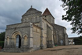 The church in Saint-Philippe-d'Aiguille | |
show Location of Saint-Philippe-d'Aiguille | |
 Saint-Philippe-d'Aiguille | |
| Coordinates: 44°54′51″N 0°01′47″W / 44.9142°N 0.0297°WCoordinates: 44°54′51″N 0°01′47″W / 44.9142°N 0.0297°W | |
| Country | France |
| Region | Nouvelle-Aquitaine |
| Department | Gironde |
| Arrondissement | Libourne |
| Canton | Les Coteaux de Dordogne |
| Government | |
| • Mayor (2008–2014) | Roger Pazat |
| Area 1 | 5.87 km2 (2.27 sq mi) |
| Population (Jan. 2018)[1] | 374 |
| • Density | 64/km2 (170/sq mi) |
| Time zone | UTC+01:00 (CET) |
| • Summer (DST) | UTC+02:00 (CEST) |
| INSEE/Postal code | 33461 /33350 |
| Elevation | 38–117 m (125–384 ft) (avg. 107 m or 351 ft) |
| 1 French Land Register data, which excludes lakes, ponds, glaciers > 1 km2 (0.386 sq mi or 247 acres) and river estuaries. | |


Saint-Philippe-d'Aiguille (Occitan: Sent Filipe d'Aguilha) is a commune in the Gironde department in Nouvelle-Aquitaine in southwestern France.
Population[]
| Year | Pop. | ±% |
|---|---|---|
| 1962 | 344 | — |
| 1968 | 364 | +5.8% |
| 1975 | 386 | +6.0% |
| 1982 | 353 | −8.5% |
| 1990 | 394 | +11.6% |
| 1999 | 424 | +7.6% |
| 2008 | 439 | +3.5% |
See also[]
References[]
- ^ "Populations légales 2018". INSEE. 28 December 2020.
| Wikimedia Commons has media related to Saint-Philippe-d'Aiguille. |
This Gironde geographical article is a stub. You can help Wikipedia by . |
Categories:
- Communes of Gironde
- Gironde geography stubs