Hure, Gironde
Hure | |
|---|---|
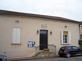 Town hall | |
show Location of Hure | |
 Hure | |
| Coordinates: 44°32′44″N 0°00′05″E / 44.5456°N 0.0014°ECoordinates: 44°32′44″N 0°00′05″E / 44.5456°N 0.0014°E | |
| Country | France |
| Region | Nouvelle-Aquitaine |
| Department | Gironde |
| Arrondissement | Langon |
| Canton | Le Réolais et Les Bastides |
| Intercommunality | Réolais en Sud Gironde |
| Government | |
| • Mayor (2008–2014) | Chantal Picon |
| Area 1 | 7.09 km2 (2.74 sq mi) |
| Population (Jan. 2018)[1] | 528 |
| • Density | 74/km2 (190/sq mi) |
| Time zone | UTC+01:00 (CET) |
| • Summer (DST) | UTC+02:00 (CEST) |
| INSEE/Postal code | 33204 /33190 |
| Elevation | 12–63 m (39–207 ft) (avg. 26 m or 85 ft) |
| 1 French Land Register data, which excludes lakes, ponds, glaciers > 1 km2 (0.386 sq mi or 247 acres) and river estuaries. | |


Hure is a commune in the Gironde department in Nouvelle-Aquitaine in southwestern France.
Population[]
| Year | Pop. | ±% |
|---|---|---|
| 1962 | 465 | — |
| 1968 | 528 | +13.5% |
| 1975 | 508 | −3.8% |
| 1982 | 435 | −14.4% |
| 1990 | 438 | +0.7% |
| 1999 | 438 | +0.0% |
| 2008 | 486 | +11.0% |
See also[]
References[]
- ^ "Populations légales 2018". INSEE. 28 December 2020.
| Wikimedia Commons has media related to Hure (Gironde). |
This Gironde geographical article is a stub. You can help Wikipedia by . |
Categories:
- Communes of Gironde
- Gironde geography stubs